Soil loss
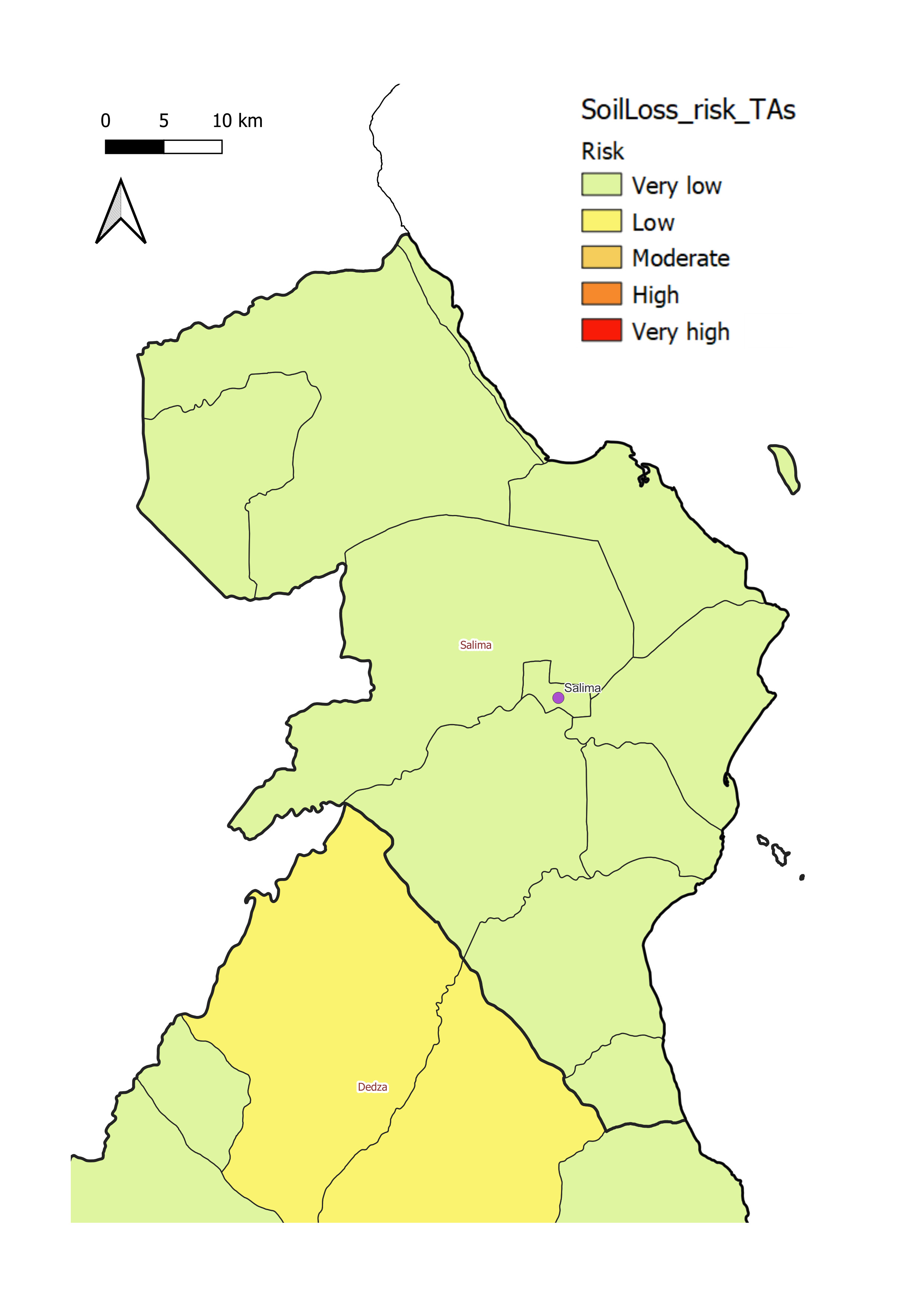
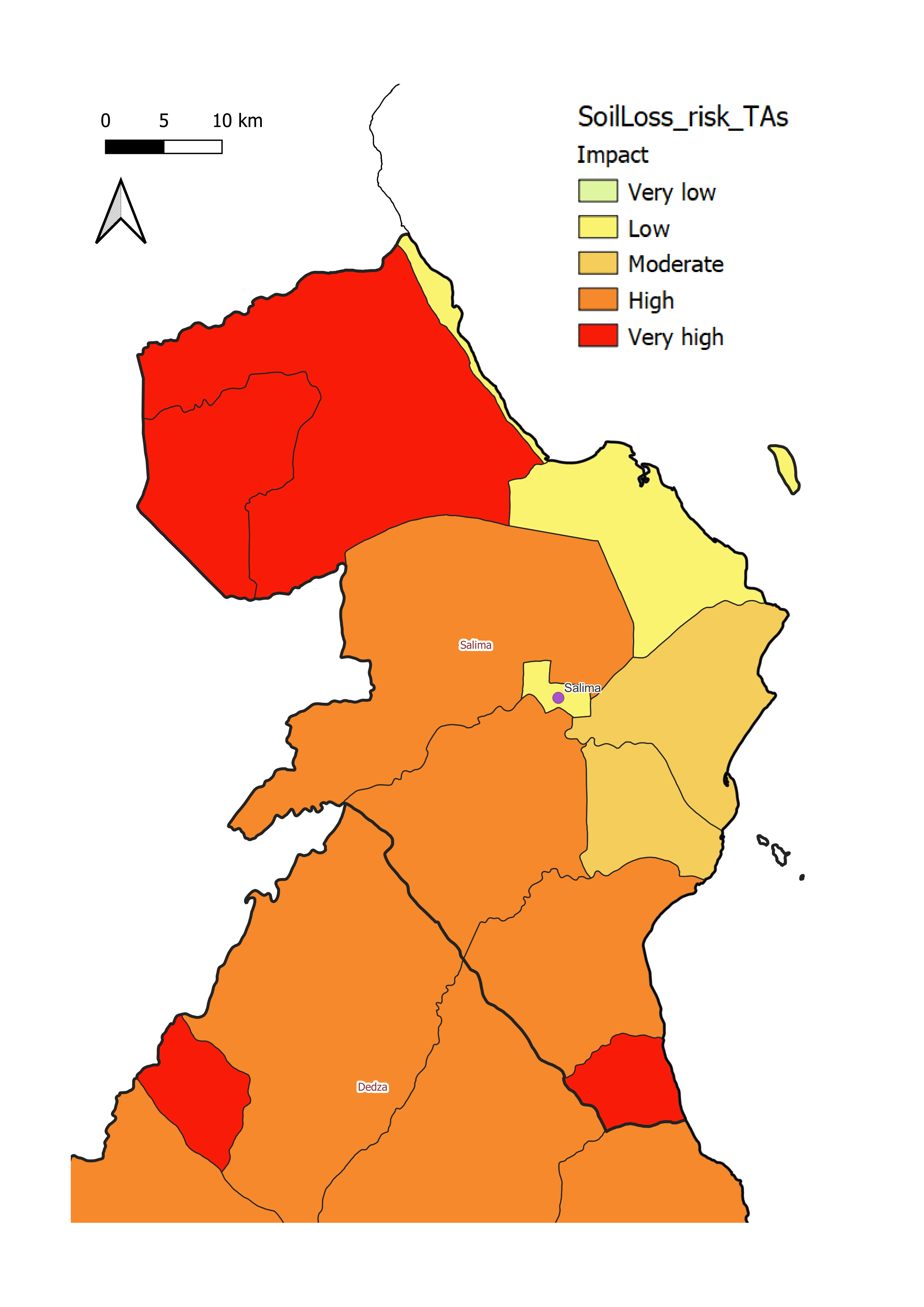
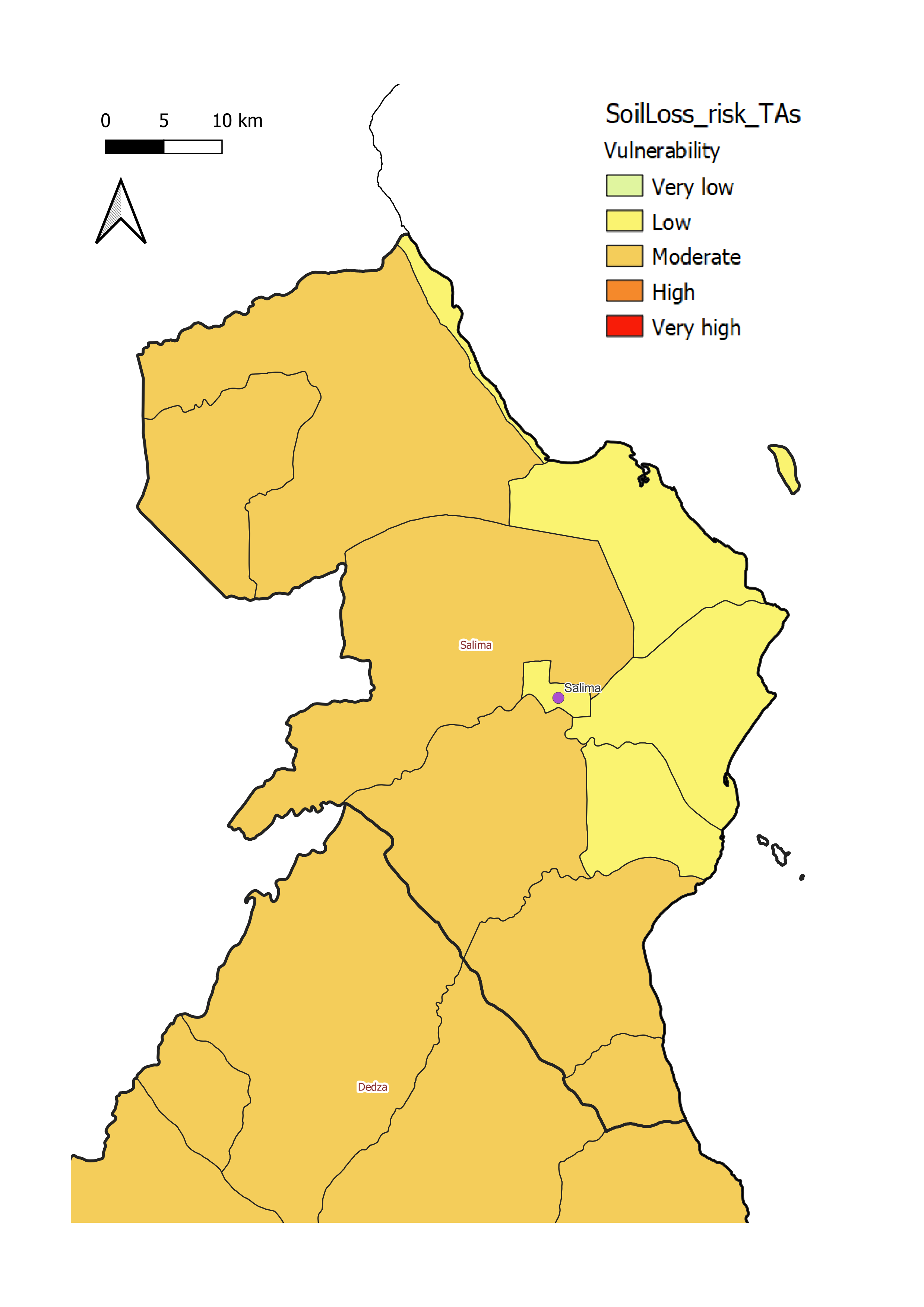
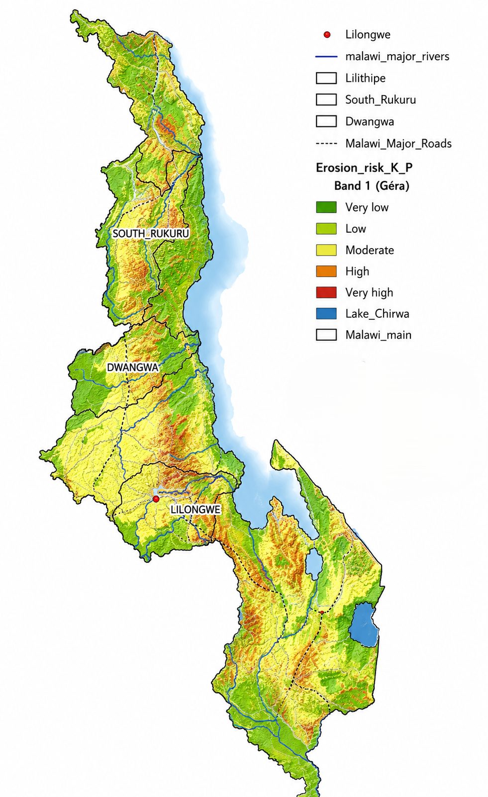
Soil loss risks at national and district levels, mapped by risk, impact and vulnerability across Malawi.
The maps below illustrate soil loss risks at national and district levels, categorised by colour-coded levels for easy interpretation:
Information about the data analysis and the methodology can be found in the methodology documentation.
Risk of soil loss
shows the likelihood of soil loss occurring in different areas, categorised as low, moderate or high risk. These maps help to identify districts that may require targeted soil management or erosion prevention measures.
Impact of soil loss
Shows the potential consequences of soil loss, categorising impacted areas as low, moderate or high impact. High-impact areas may face threats such as reduced agricultural productivity, infrastructure damage, transport disruption, and economic loss.
Soil Loss Vulnerability
Highlights the sensitivity and adaptive capacity of communities in different districts in relation to soil loss events. Vulnerability reflects how well a population can prepare for, cope with and recover from such events.
Soil Loss by District
Balaka District
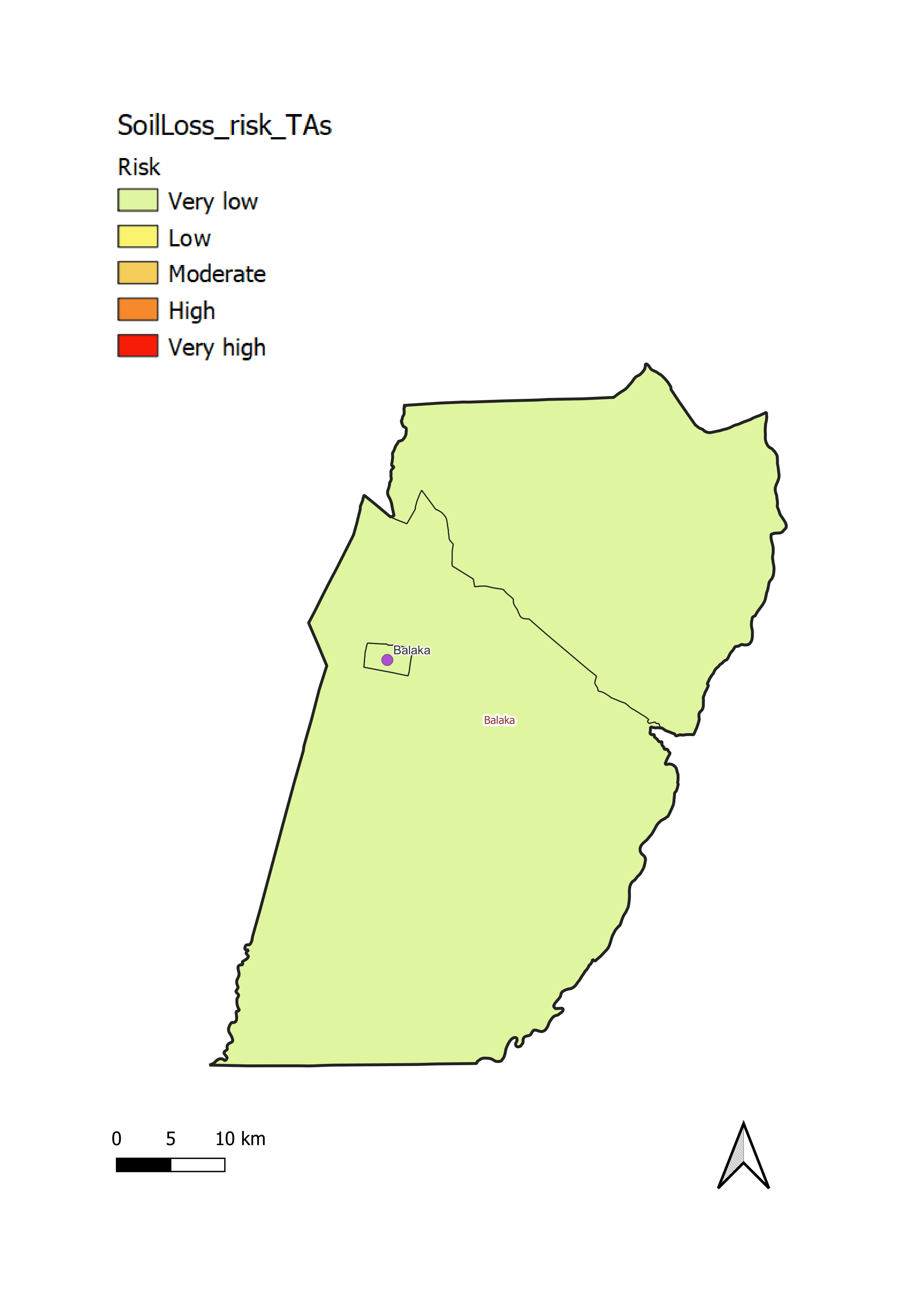
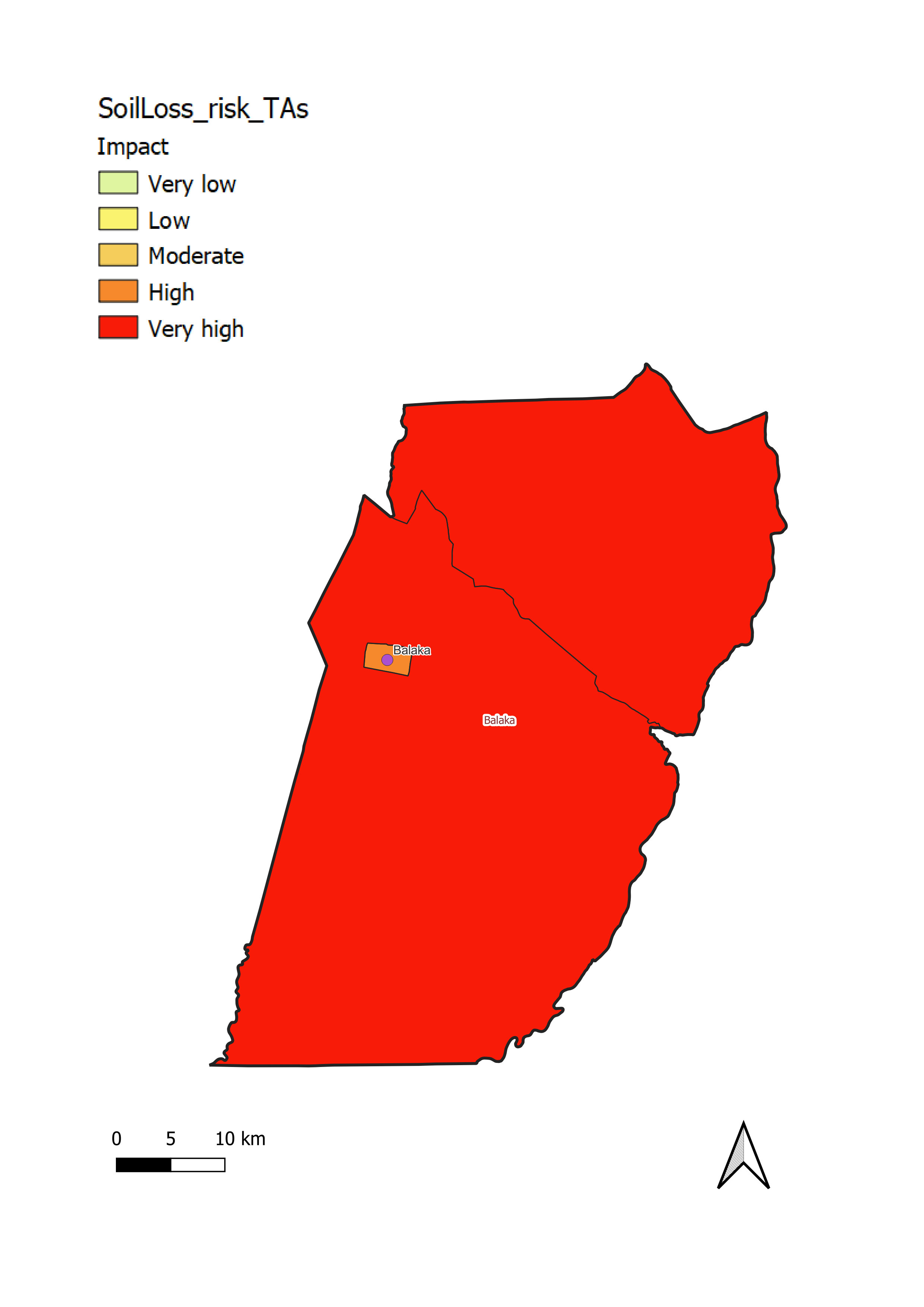
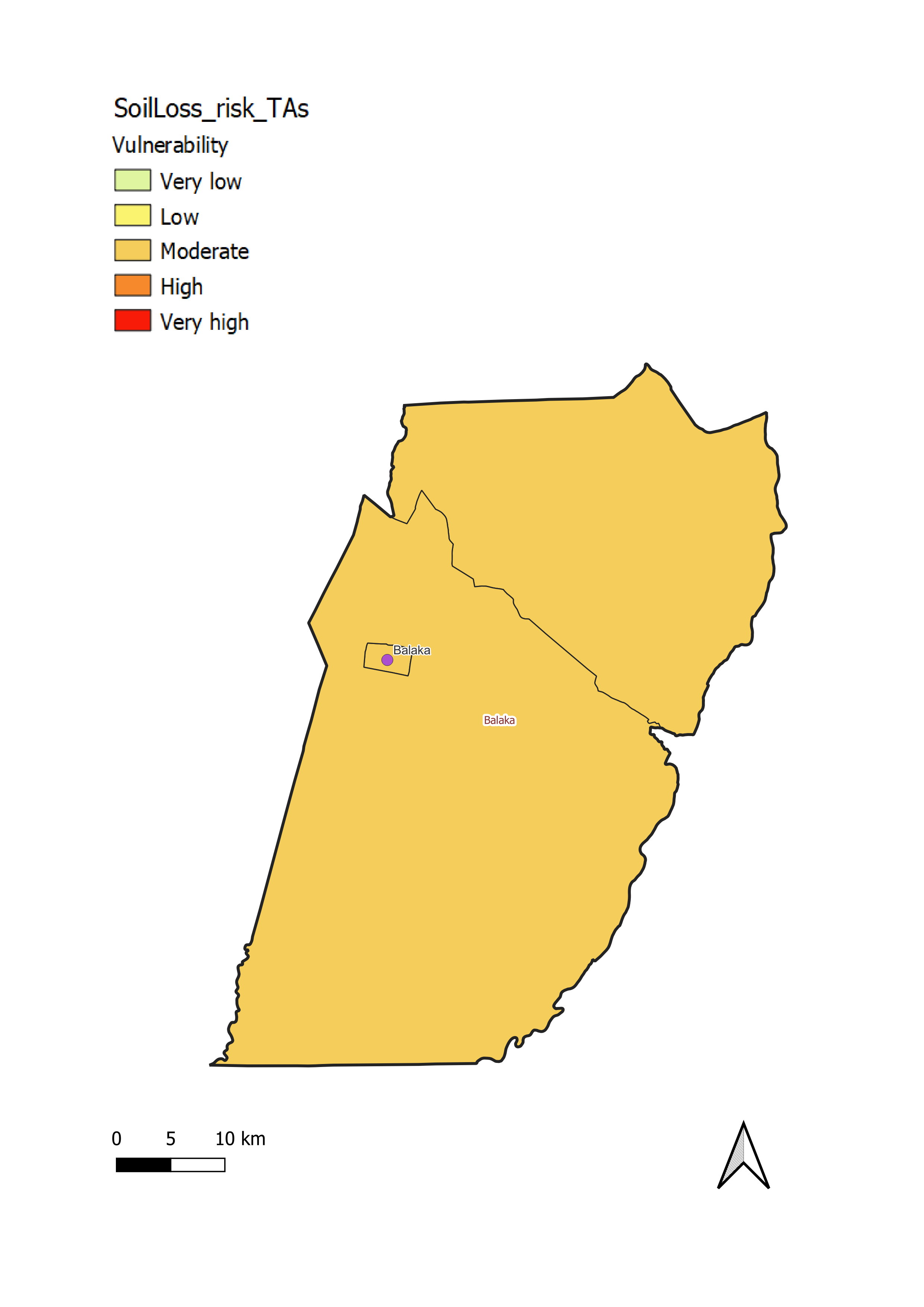
Balaka District has a moderate level of vulnerability to soil loss (c). This level of vulnerability is associated with:
- aVery low risk of soil loss throughout the district (a);
- bVery high impact of soil loss throughout the district (b), which is heavily cultivated with sparse forest cover. This highlights the importance of erosion control in the district to protect agricultural production and the water quality in the Shire River which forms the eastern boundary of the district
Chikwawa District
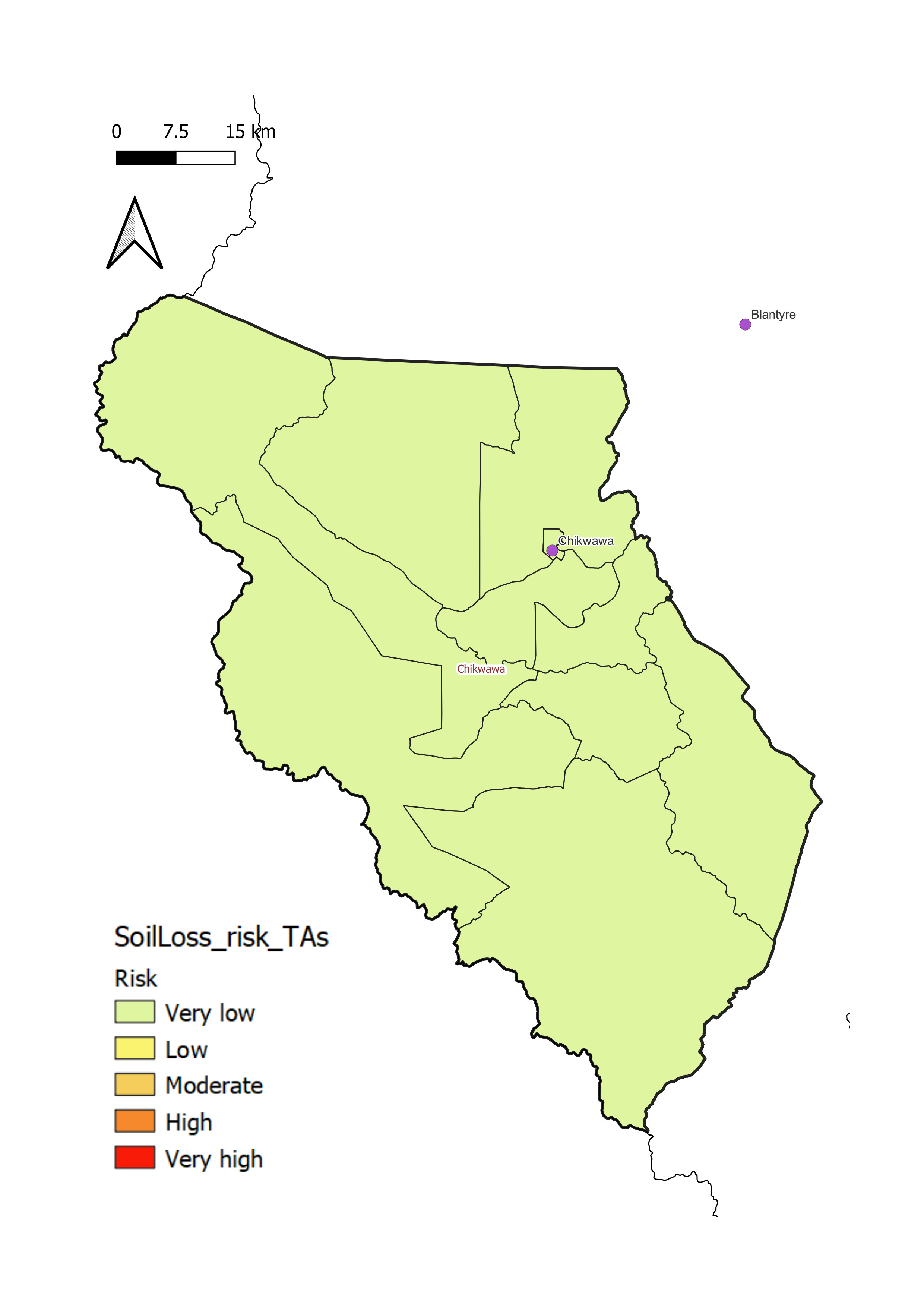
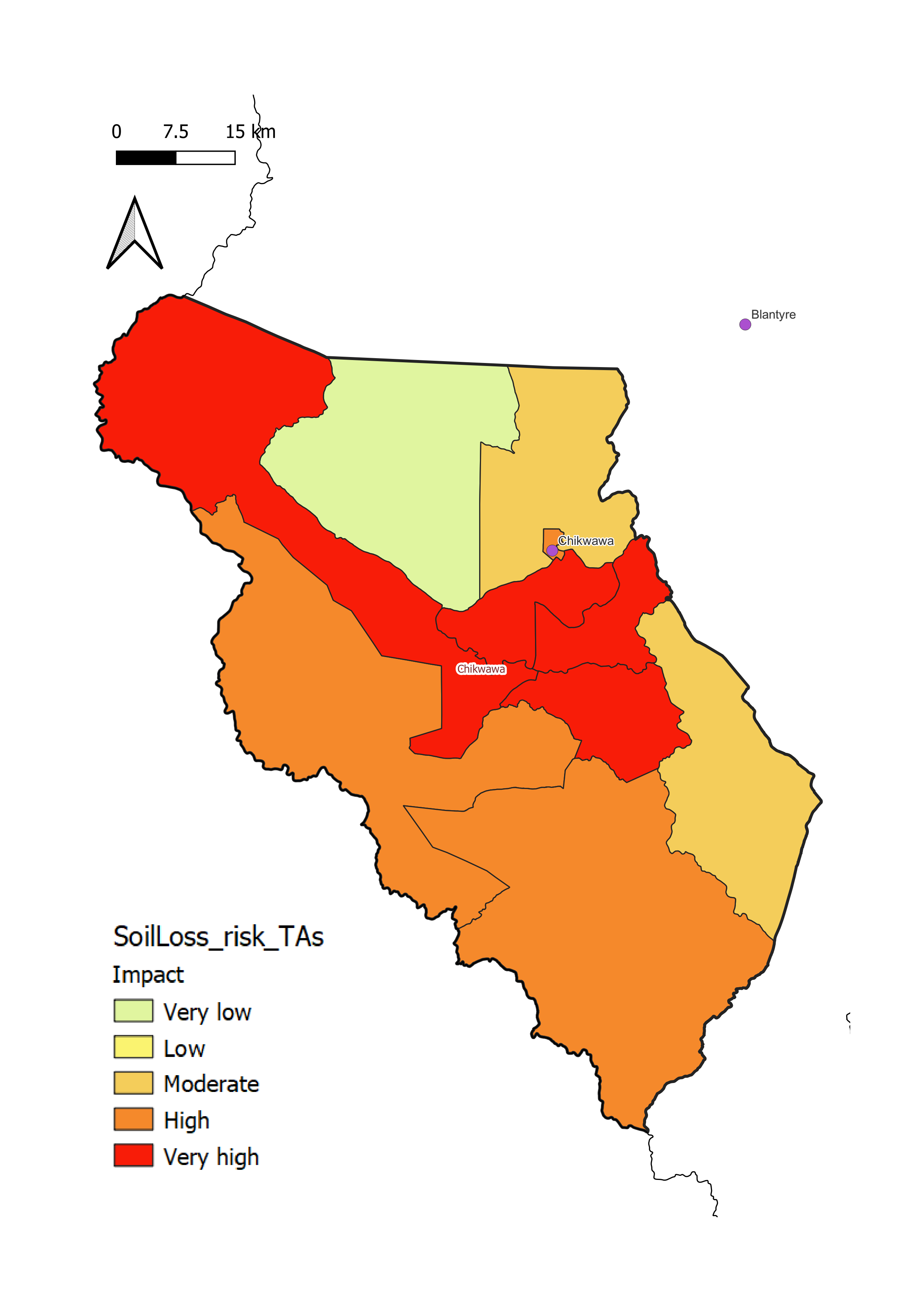
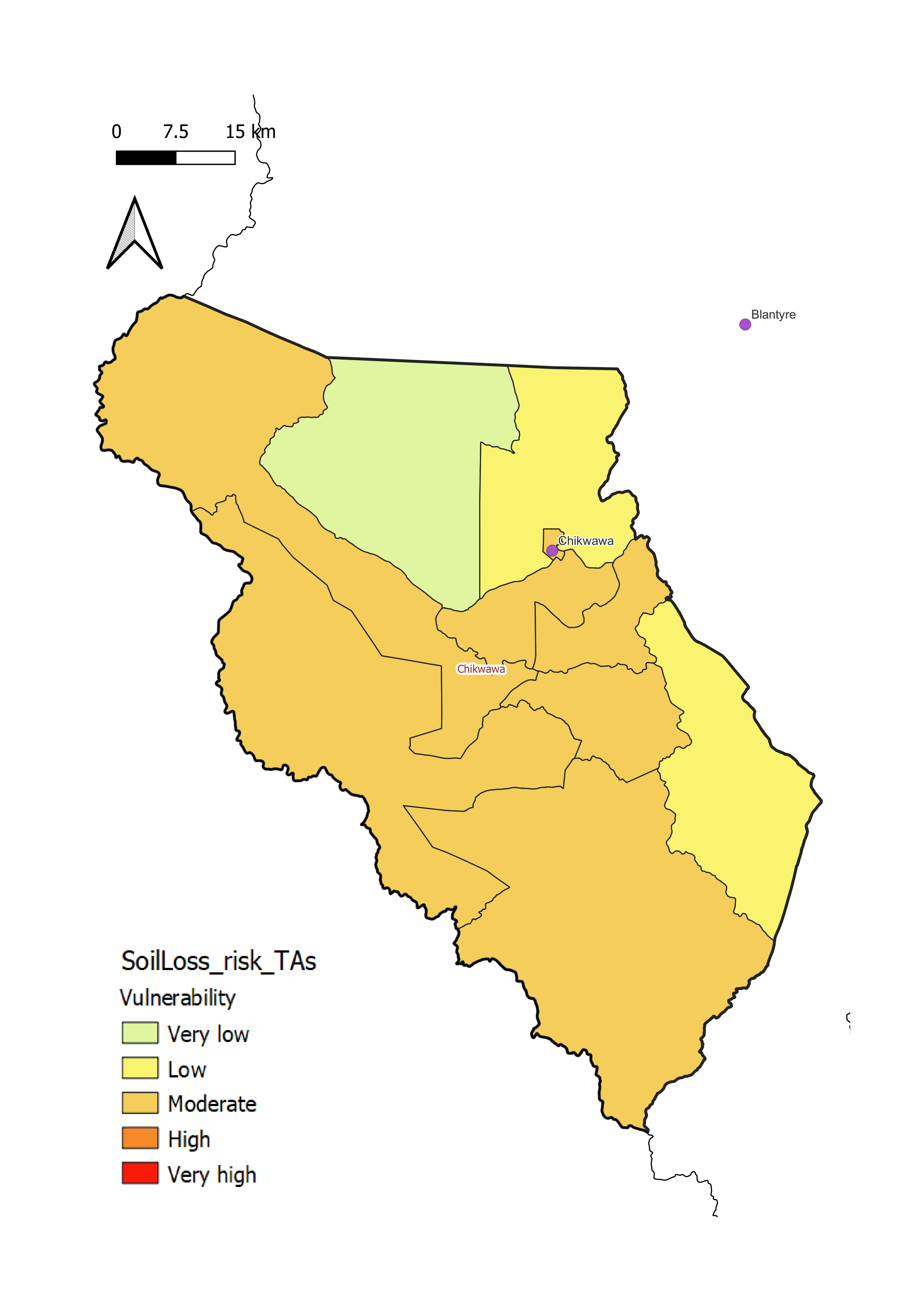
Most of Chikwawa District experiences moderate soil loss vulnerability (c). This is characterized by:
- aMostly stable land cover with low erosion risk (a);
- bExtensive cultivation and hence greater soil loss impacts, especially in the lowlands of the Shire River valley (b).
Dedza District
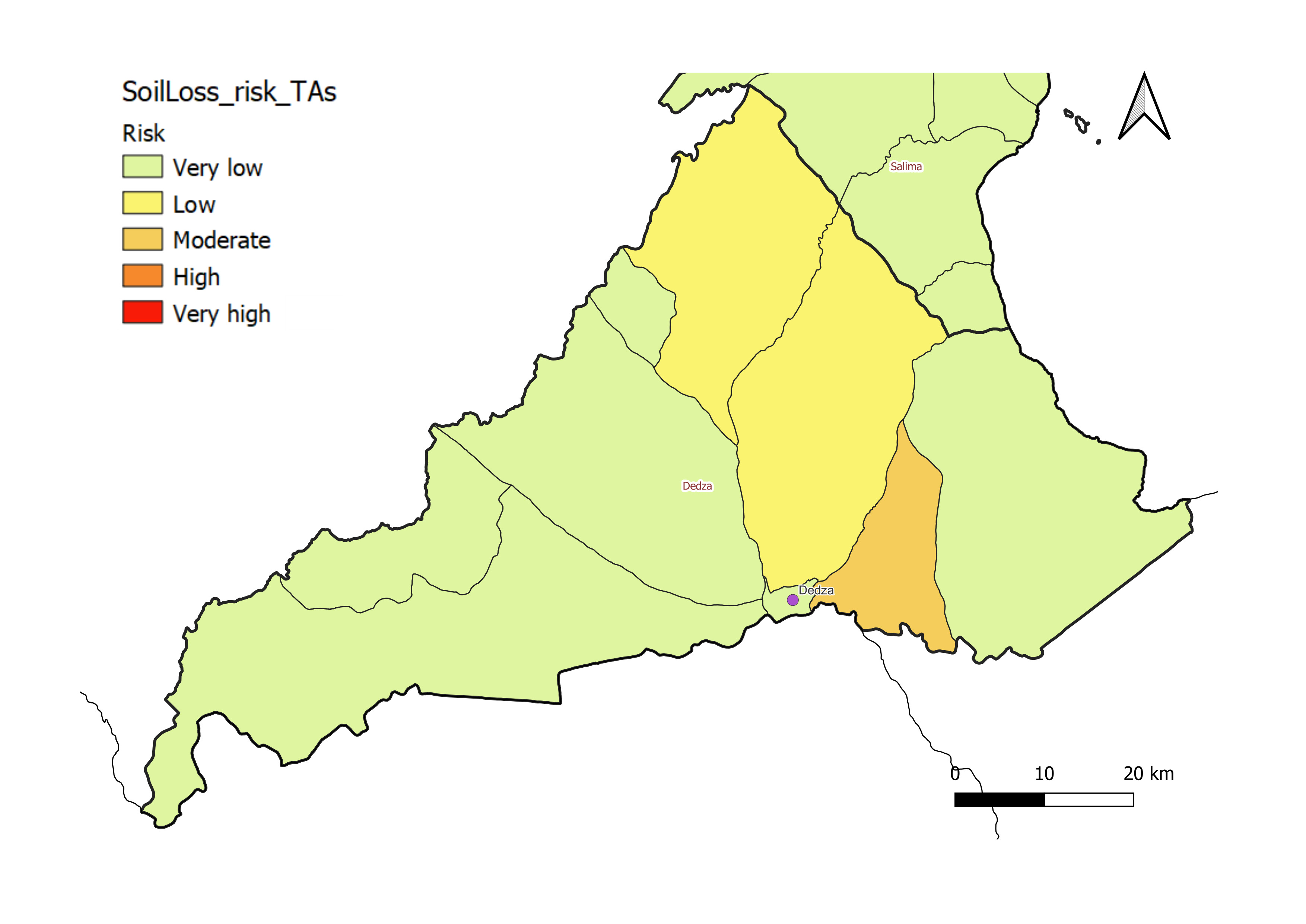
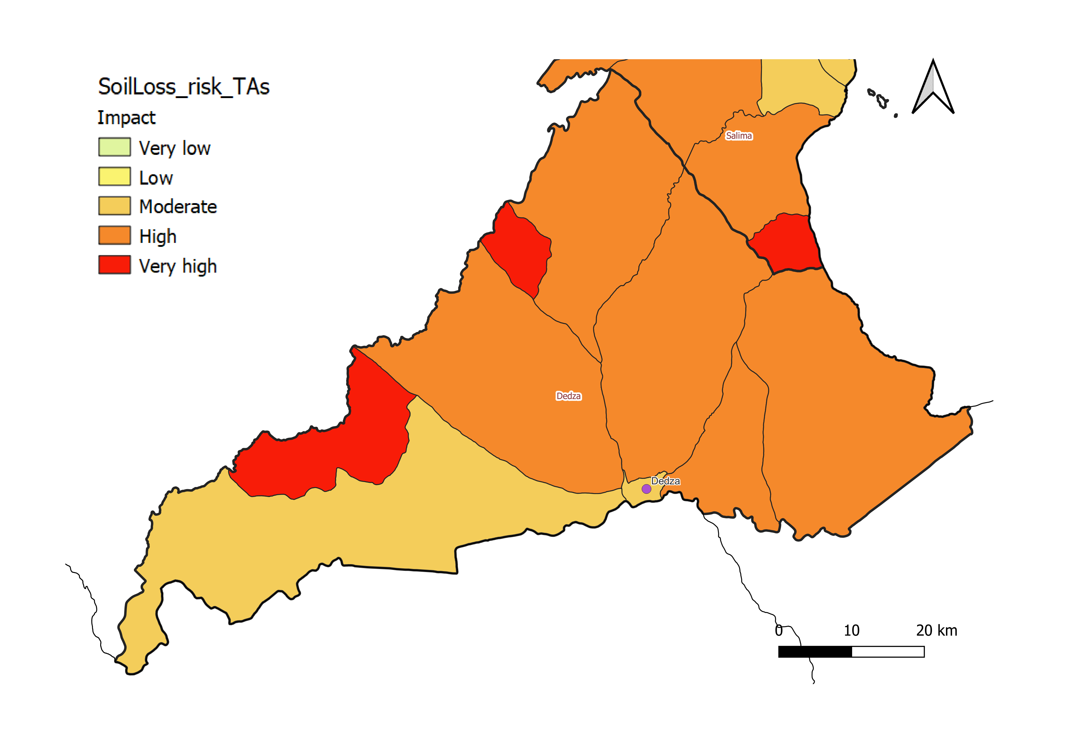
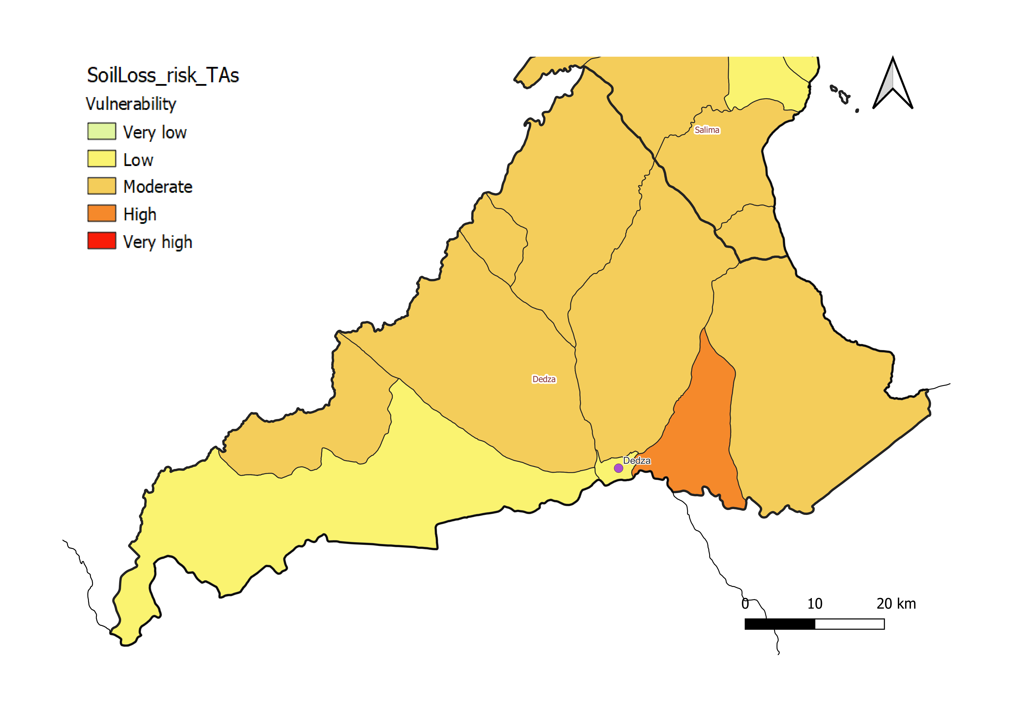
Most of Dedza District has moderate soil loss vulnerability (c). This is related to:
- aLow to moderate soil loss risk, with relatively flat, forested areas in the west giving way to undulating topography in the central and eastern parts of the district (a);
- bHigh impacts of soil loss due to extensive crop coverage, especially in the central and eastern part of the district where erosion rates are higher (b). Cultivated areas in the hilly eastern part of Dedza are especially vulnerable to soil loss, highlighting the need for targeted conservation on cultivated hillsides.
Karonga District
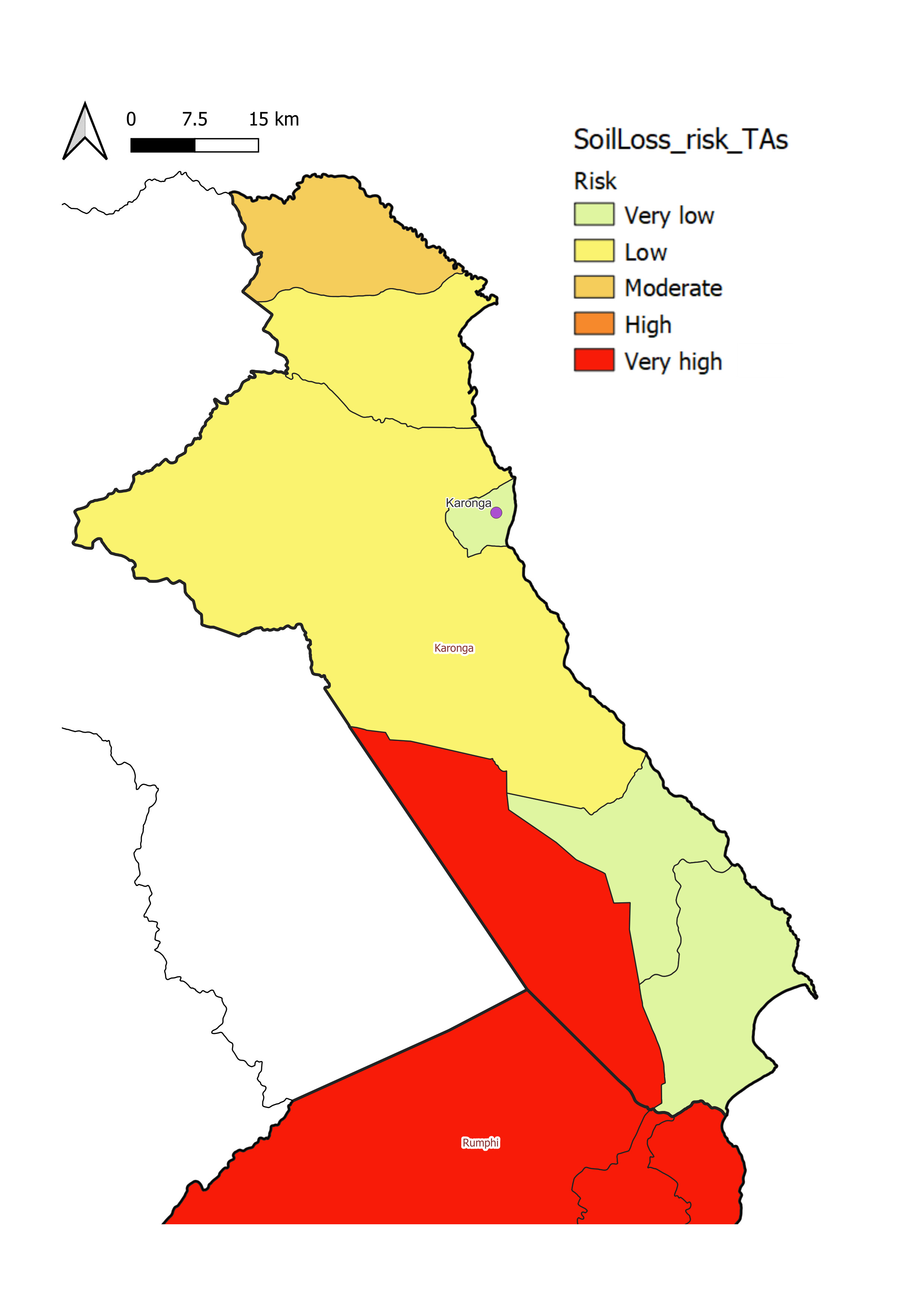
Karonga District experiences generally low to moderate soil loss, especially in the higher elevations in the western part of the district. The greatest losses occur along the northeast-facing slopes in the north of the district and along the Nyika Plateau slopes of southern Karonga, descending into Lake Malawi
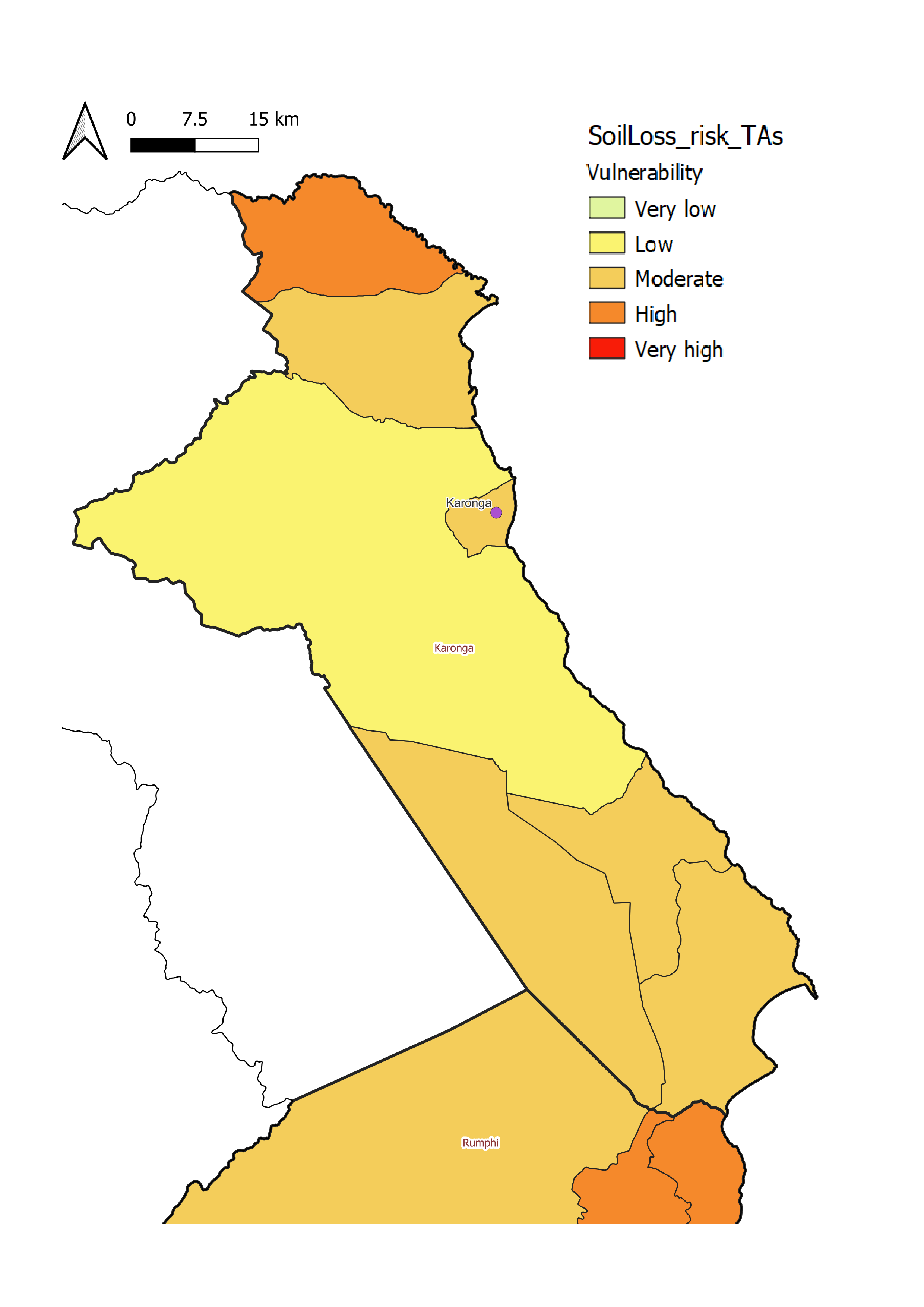
Vulnerability is generally moderate to high throughout the district (c). This is due to:
- aA moderate risk of erosion overall with locally higher risk in the northern and southern parts of the district;
- bA moderate proportion of cropland (~50%), some of which is located on sloping terrain that tends to experience higher soil loss rates.
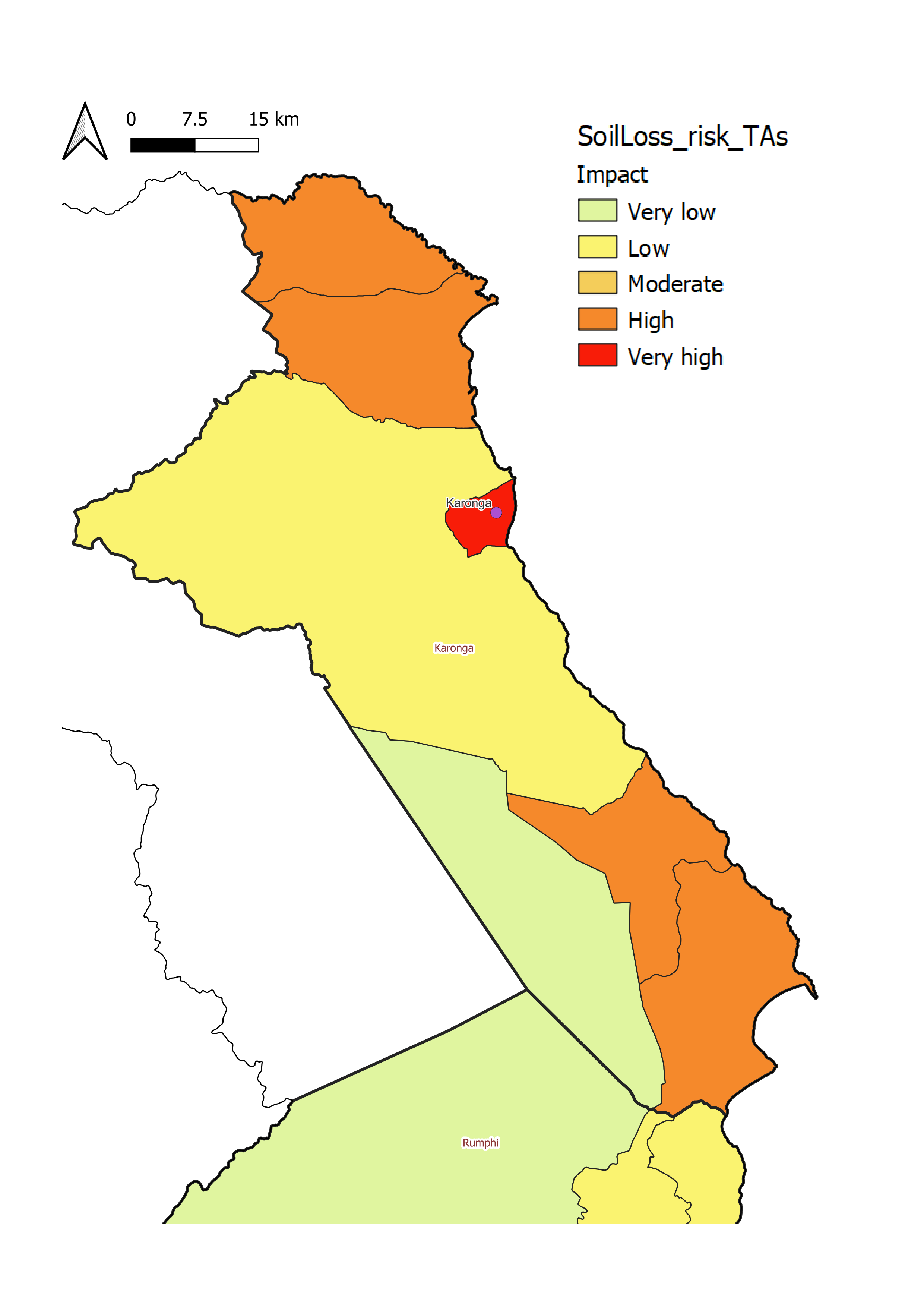
The impact of erosion in Karonga (c) is more pronouned in the north and south-east, though cultivated zones in the east could face localized productivity declines if soil conservation measures are not maintained.
Kasunga District
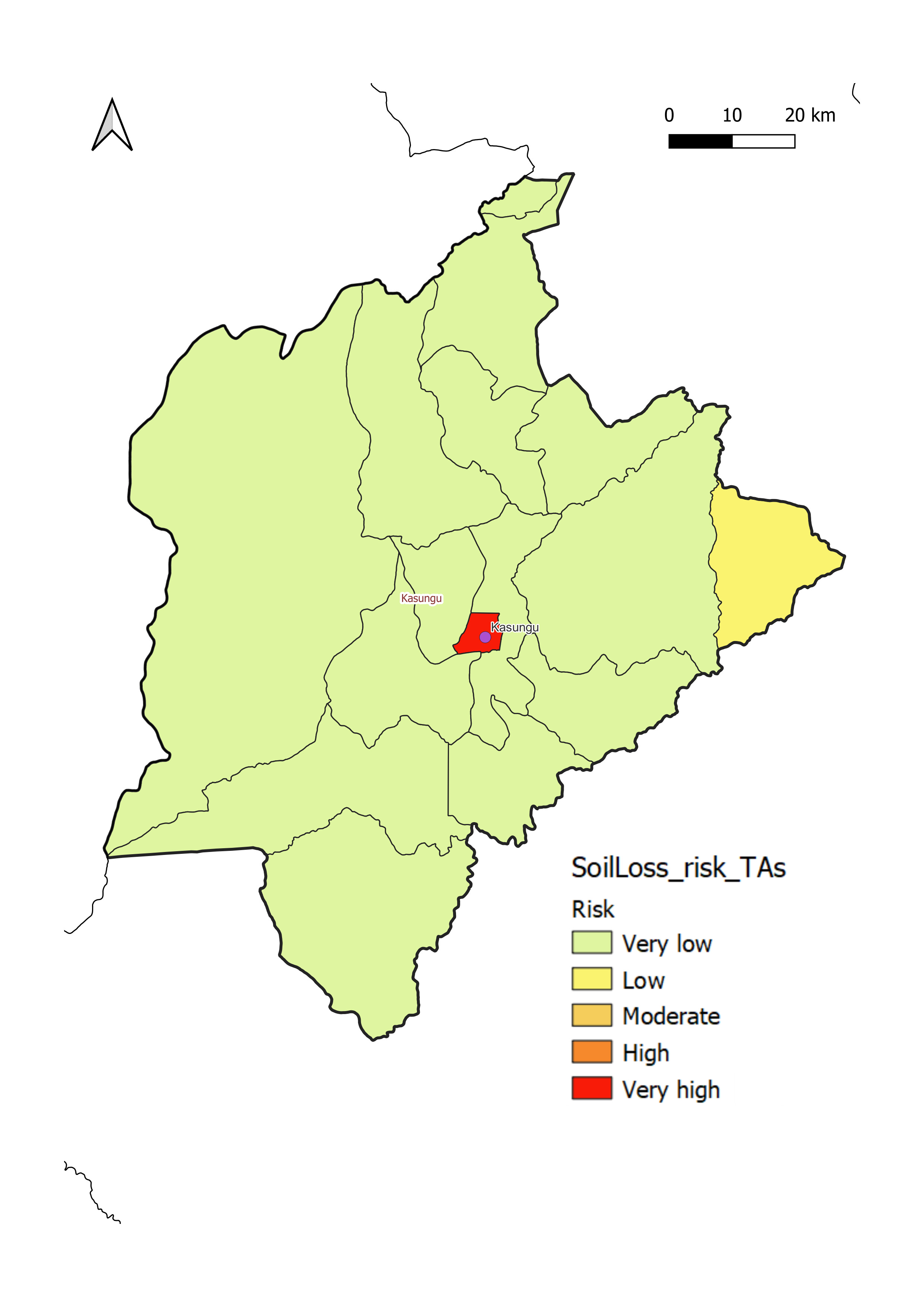
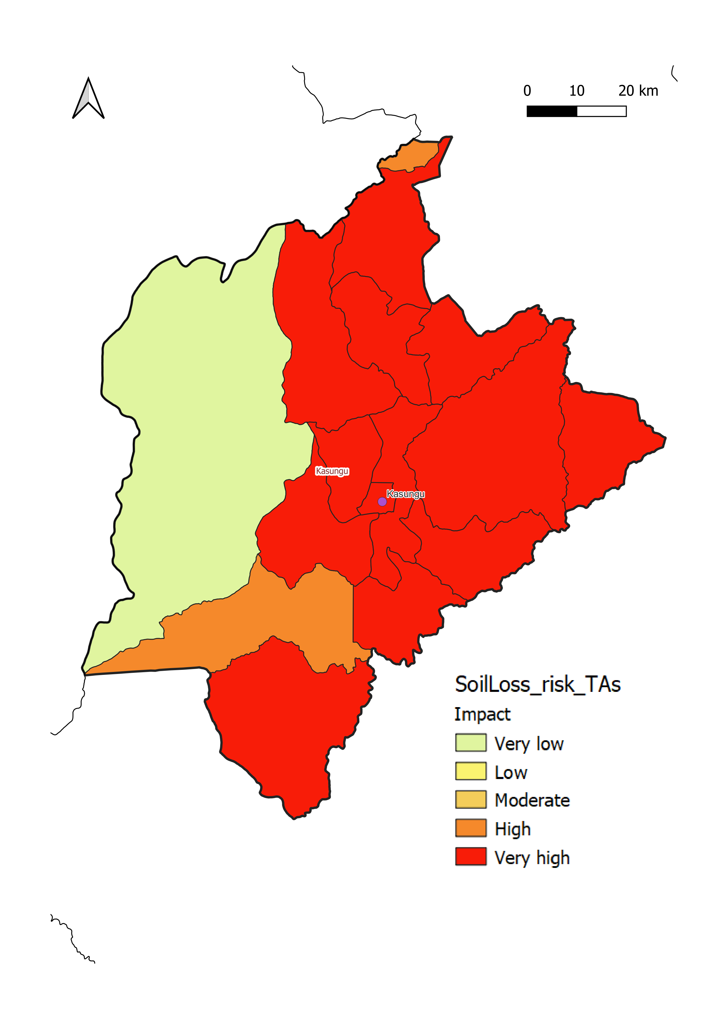
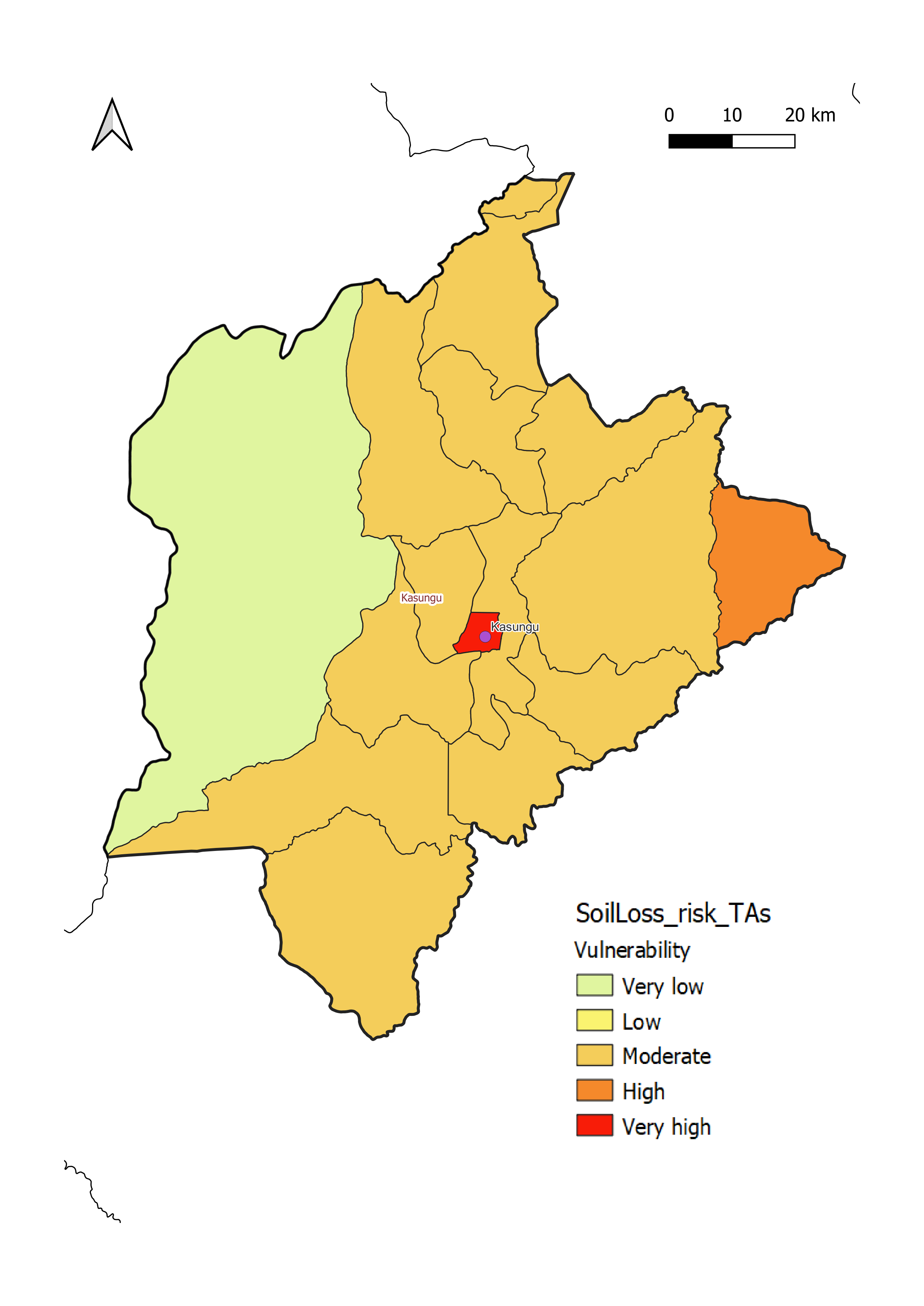
Soil loss vulnerabilty in Kasungu District is generally moderate (c). This rating is characterized by:
- aRelatively gentle topography and stable land cover, with Kasungu National Park located in the western part of the district. Higher risk areas are present along the sloping hillsides in the far eastern part of the district;
- bVery high impact of soil loss due to a large agricultural base, especially in the central and eastern parts of the district.
Phalombe District
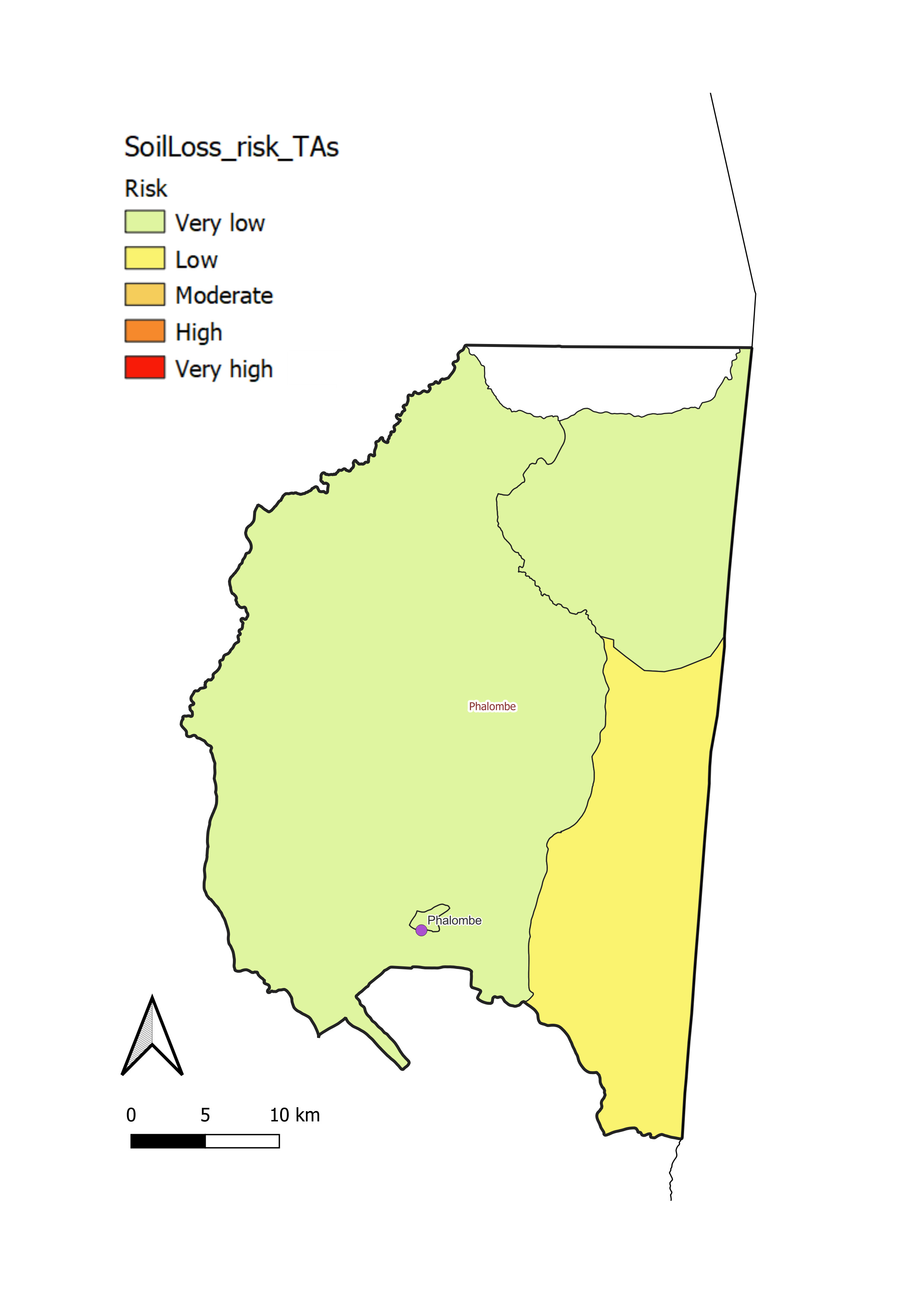
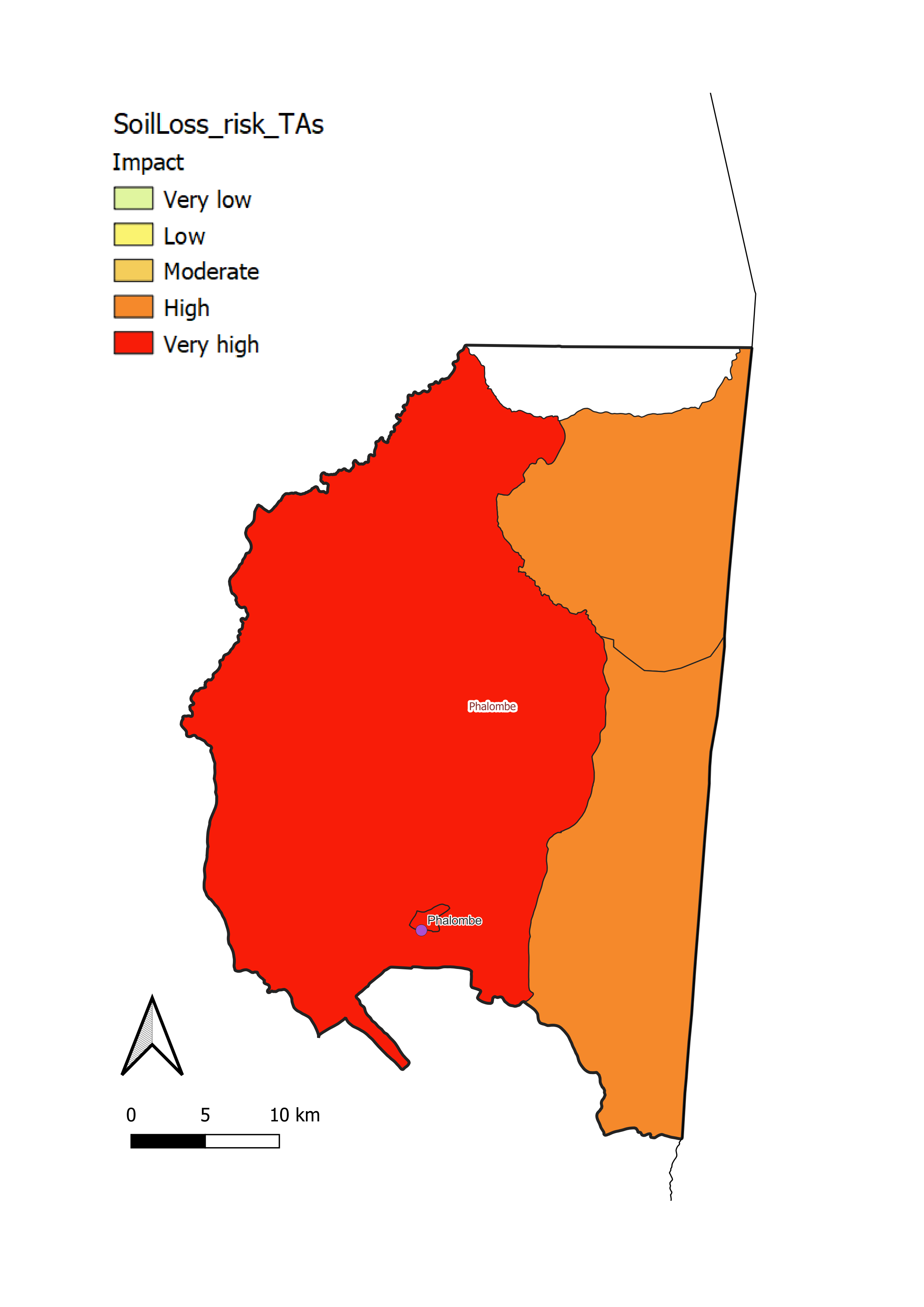
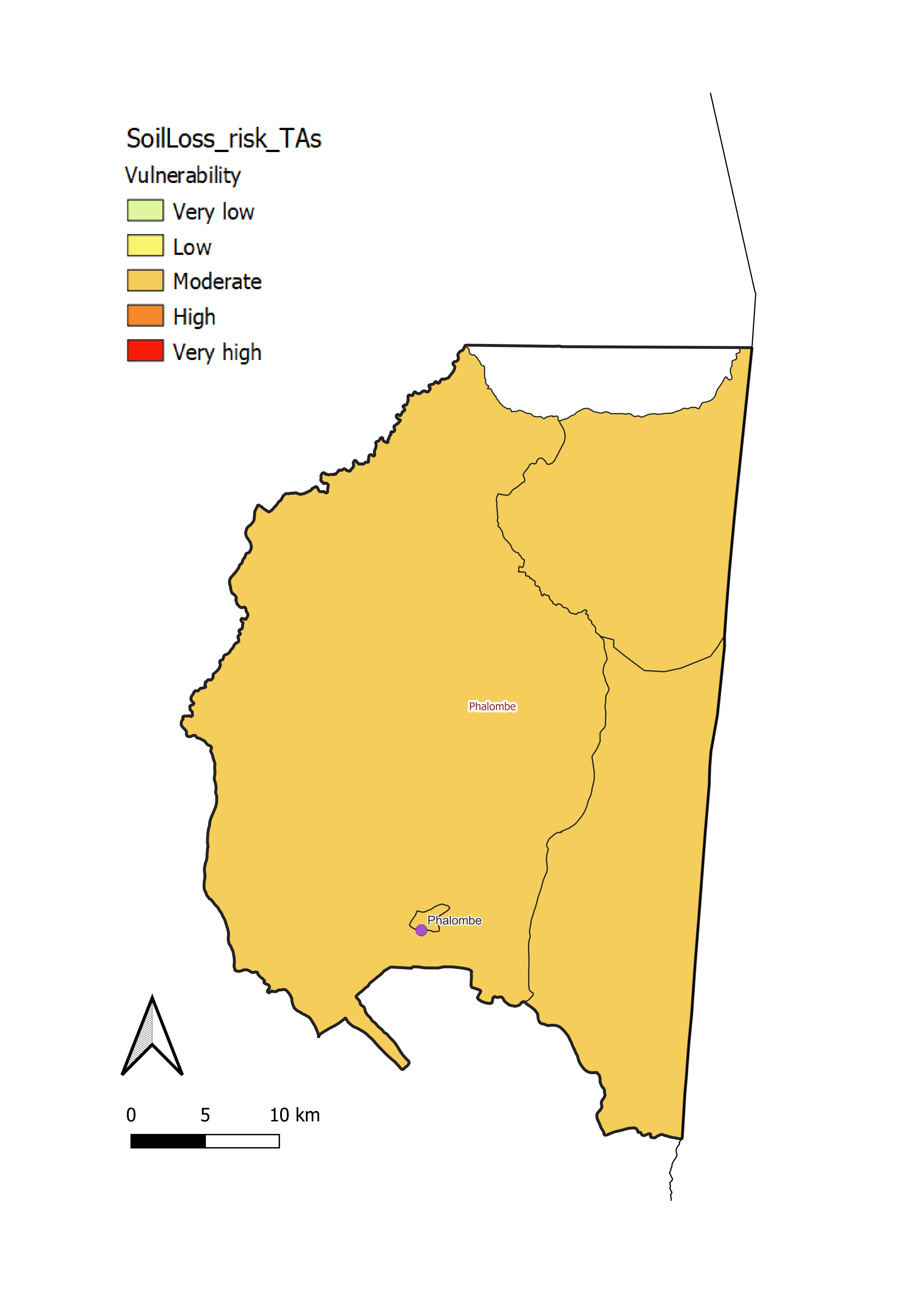
Phalombe District has moderate soil loss vulnerability (c). This is due to
- aMostly flat topography with low soil loss risk. Erosion risk is locally higher in the hillier southern part of the district (a);
- bIntensive farming throughout the district, especially in the western part, which drives increased impact (b).
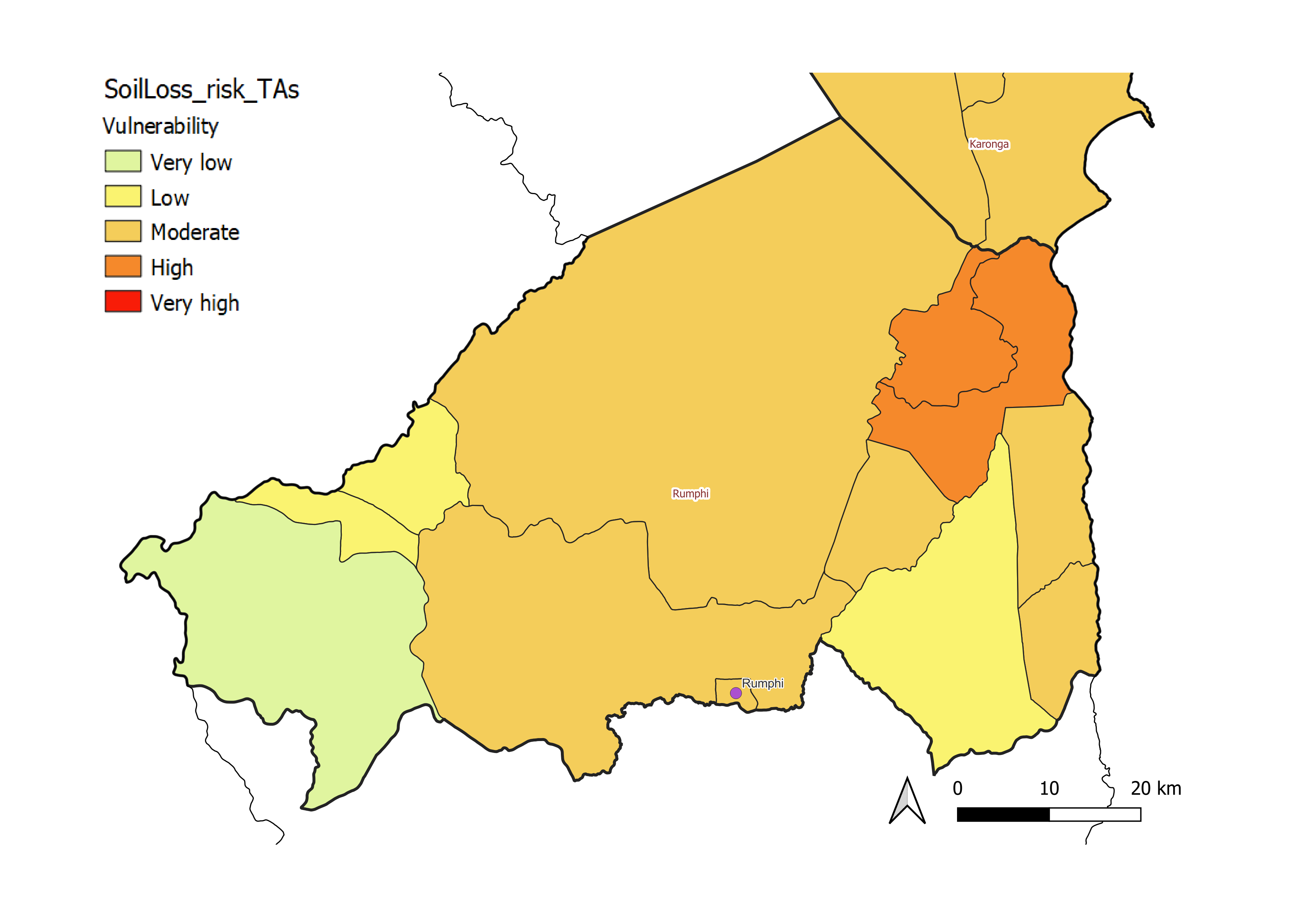
Rumphi District
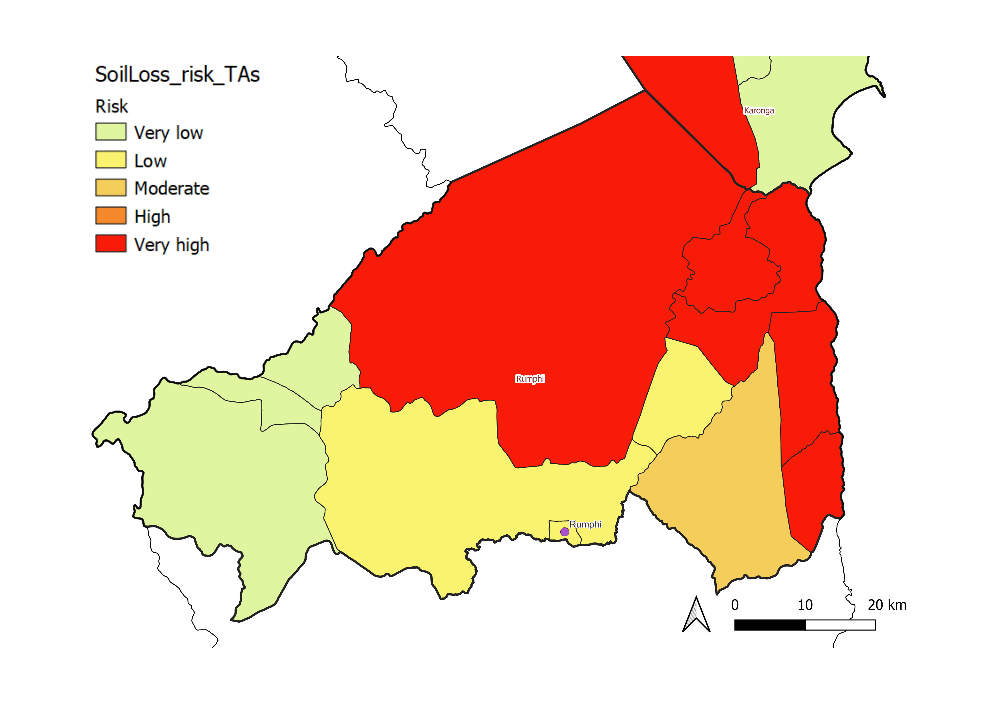
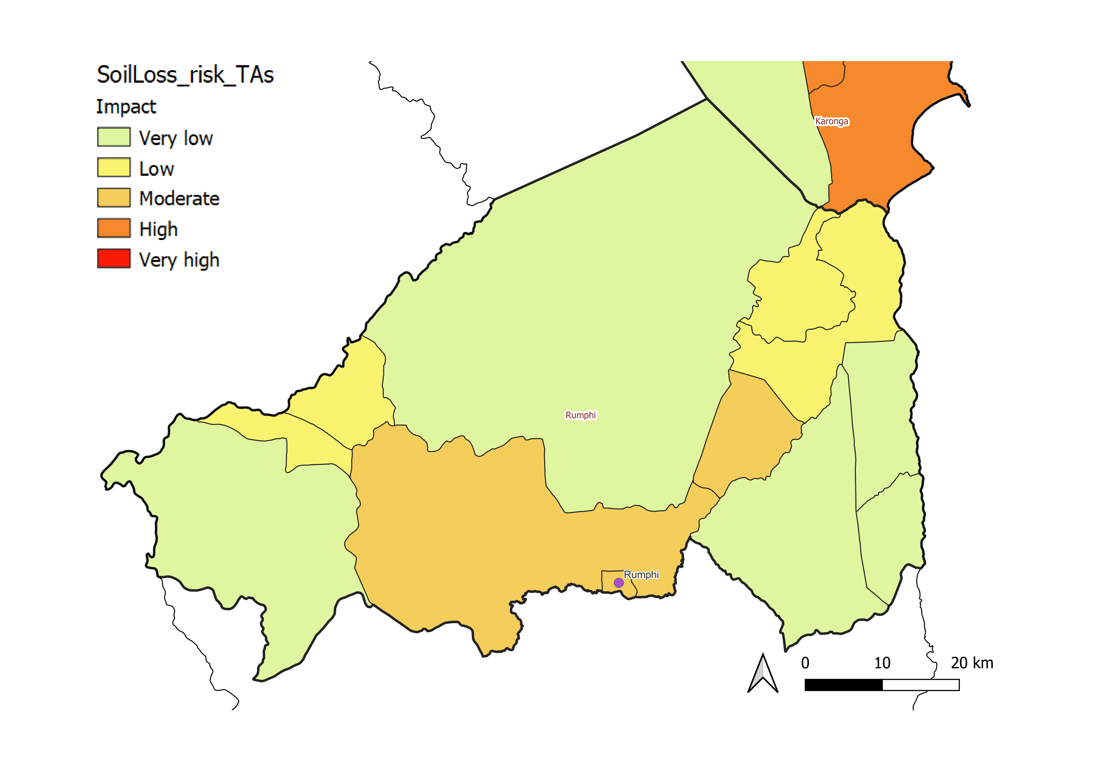
Rumphi District is highly vulnerable to soil loss (c). This is related to:
- aHigh or very high rates of annual soil loss, especially on the hilly landscapes of the upper Nyika Plateau and within the lower South Rukuru River valley;
- bA mix of forest and crop cover, with cropland concentrated in valleys and the lower Nyika plateau foothills, where higher erosion risk zones are evident.
Despite the presence of forested and protected areas, agricultural pressure in some regions increases soil loss risk and may threaten biodiversity.
Salima District
Salima has a moderate level of vulnerability to soil loss (c). This level of vulnerability is associated with:
- aVery low risk of soil loss throughout the district, which consists mostly of flat, low-lying terrain (a);
- bHigh to very high impacts of soil loss throughout the district. Impacts may be locally higher in the northern and western parts of the district (b), which are heavily cultivated with sparse forest cover. Active erosion control efforts may help to mitigate risks when heavy rains inundate the lowlands around the Lilongwe River delta.