Flood
A major hazard during the rainy season, mapped across Malawi by flood risk, impact and social vulnerability.
Risk, impact & social vulnerability
The maps below illustrate flood-related risks at national and district levels, categorised by colour-coded zoning for easy interpretation. Information about the data analysis and the methodology can be found in the methodology documentation.
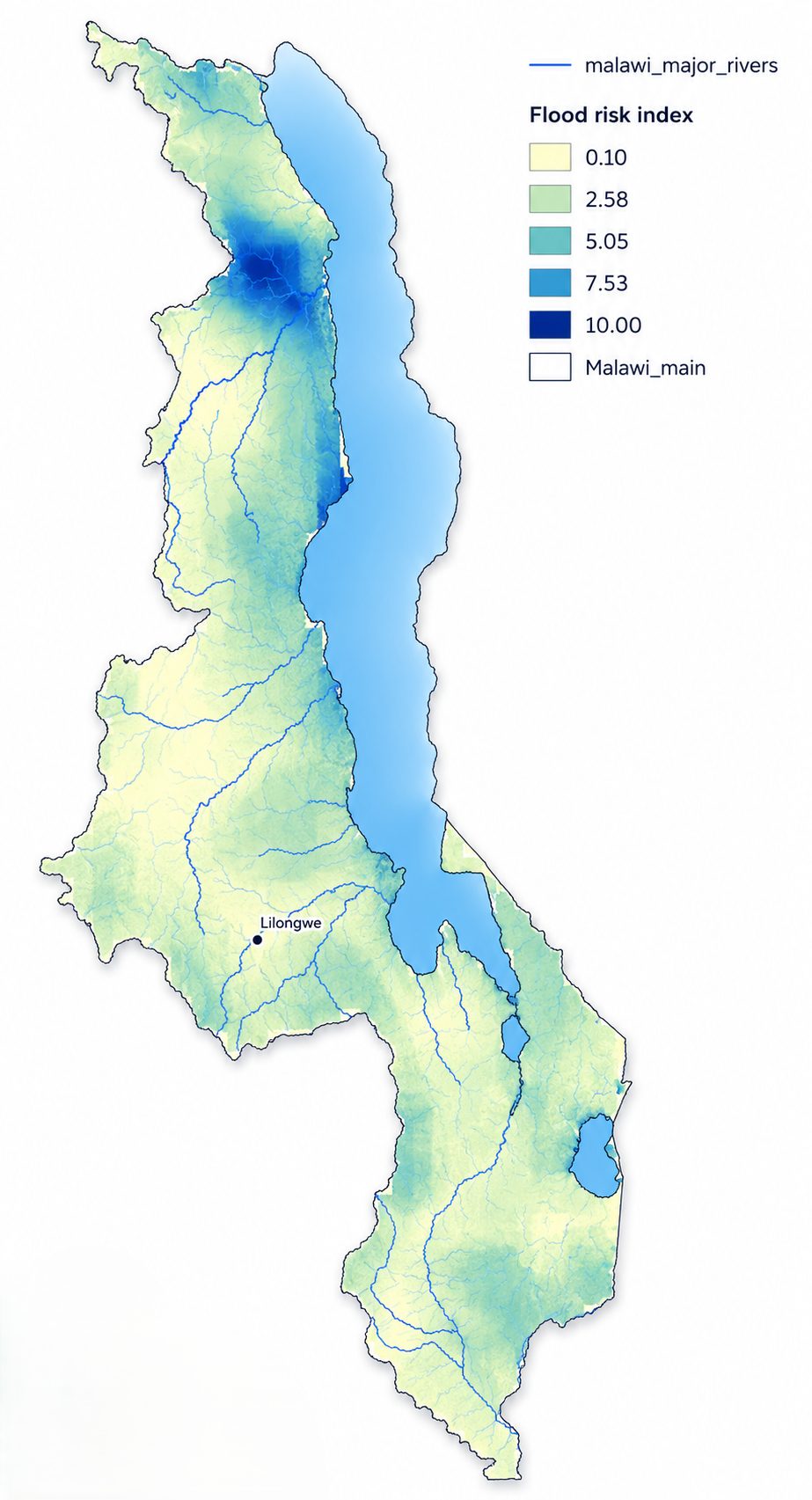
Flood risk
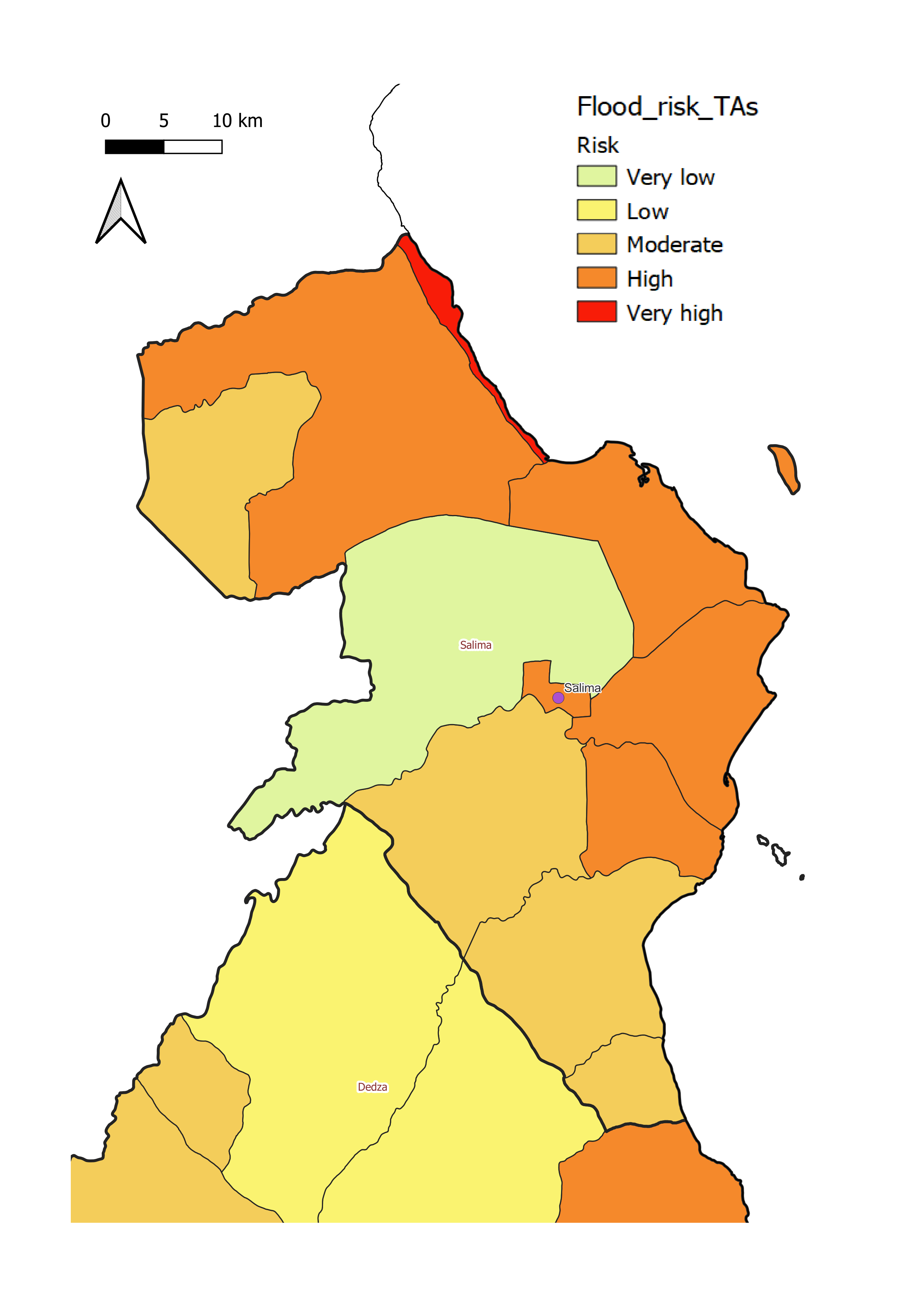
The likelihood of flooding. Helps identify districts that may require flood management or preventive measures.
Flood impact
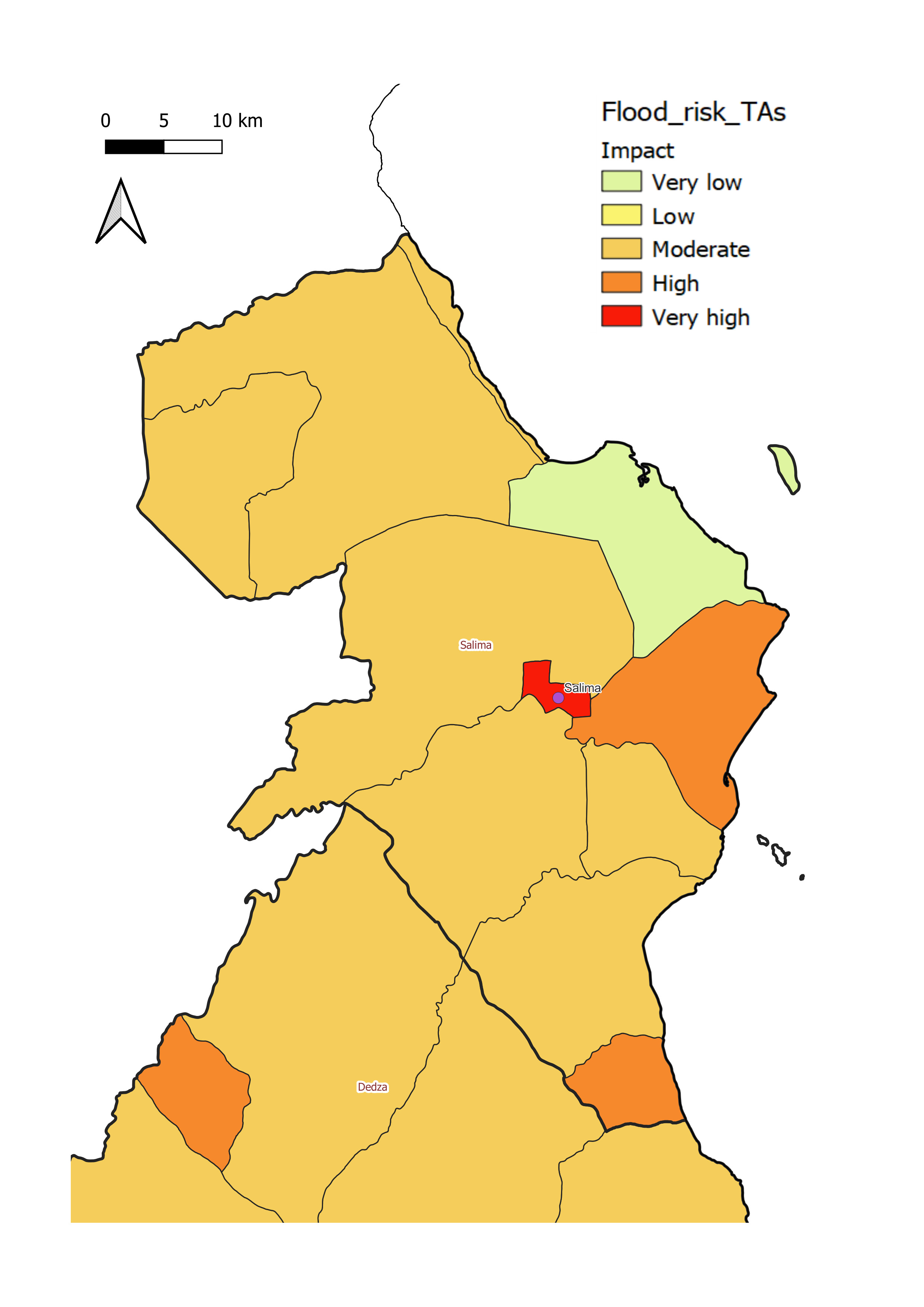
The potential consequences, loss of life, damage to livelihoods, public-health challenges, transport disruption and economic losses.
Social vulnerability
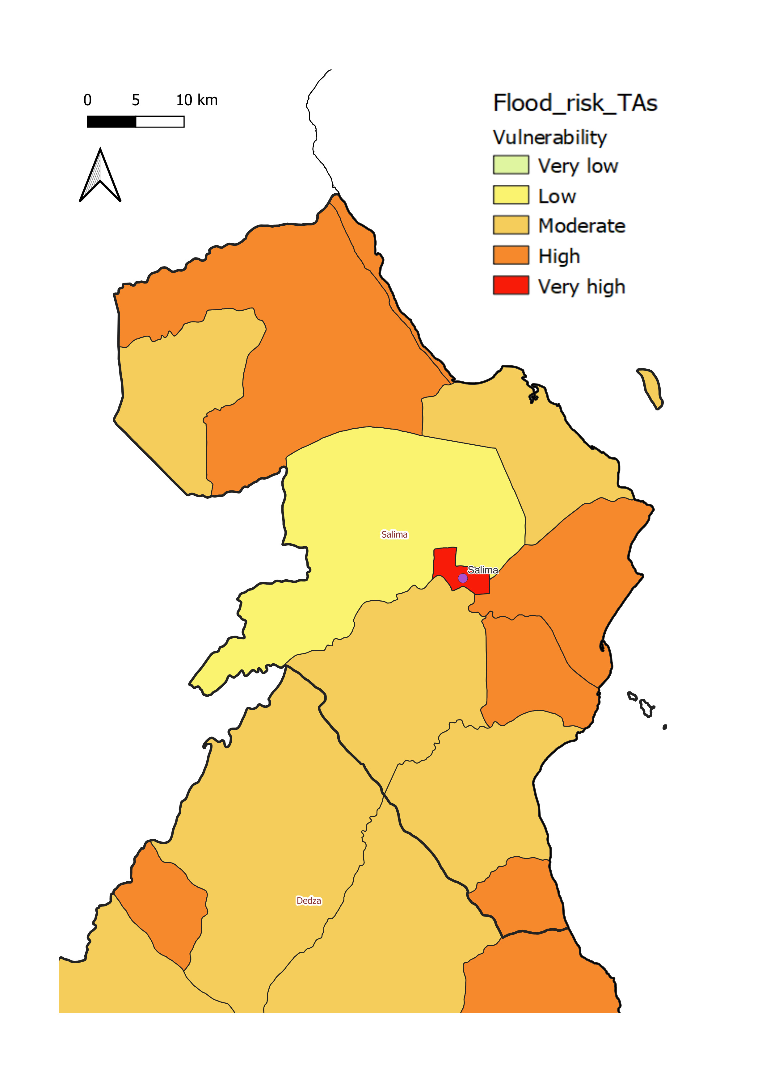
The sensitivity of communities to flood events, their capacity to prepare for, respond to and recover from floods.
District-level flood profiles
Climate challenges vary by location. Explore region-specific flood risk, impact and vulnerability maps for each district.
Balaka District
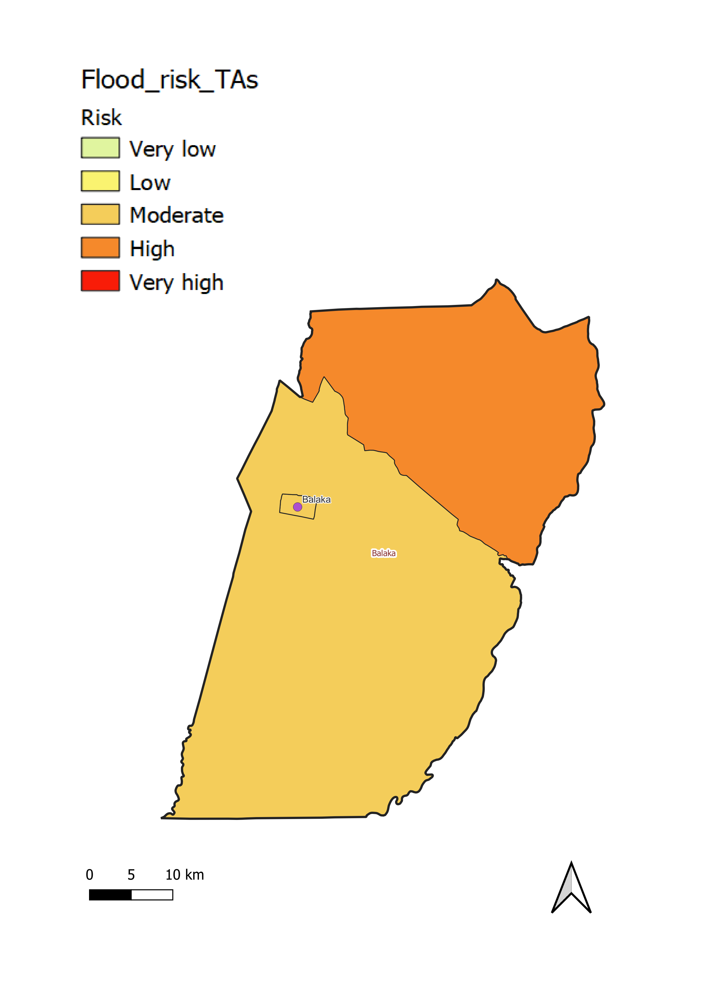
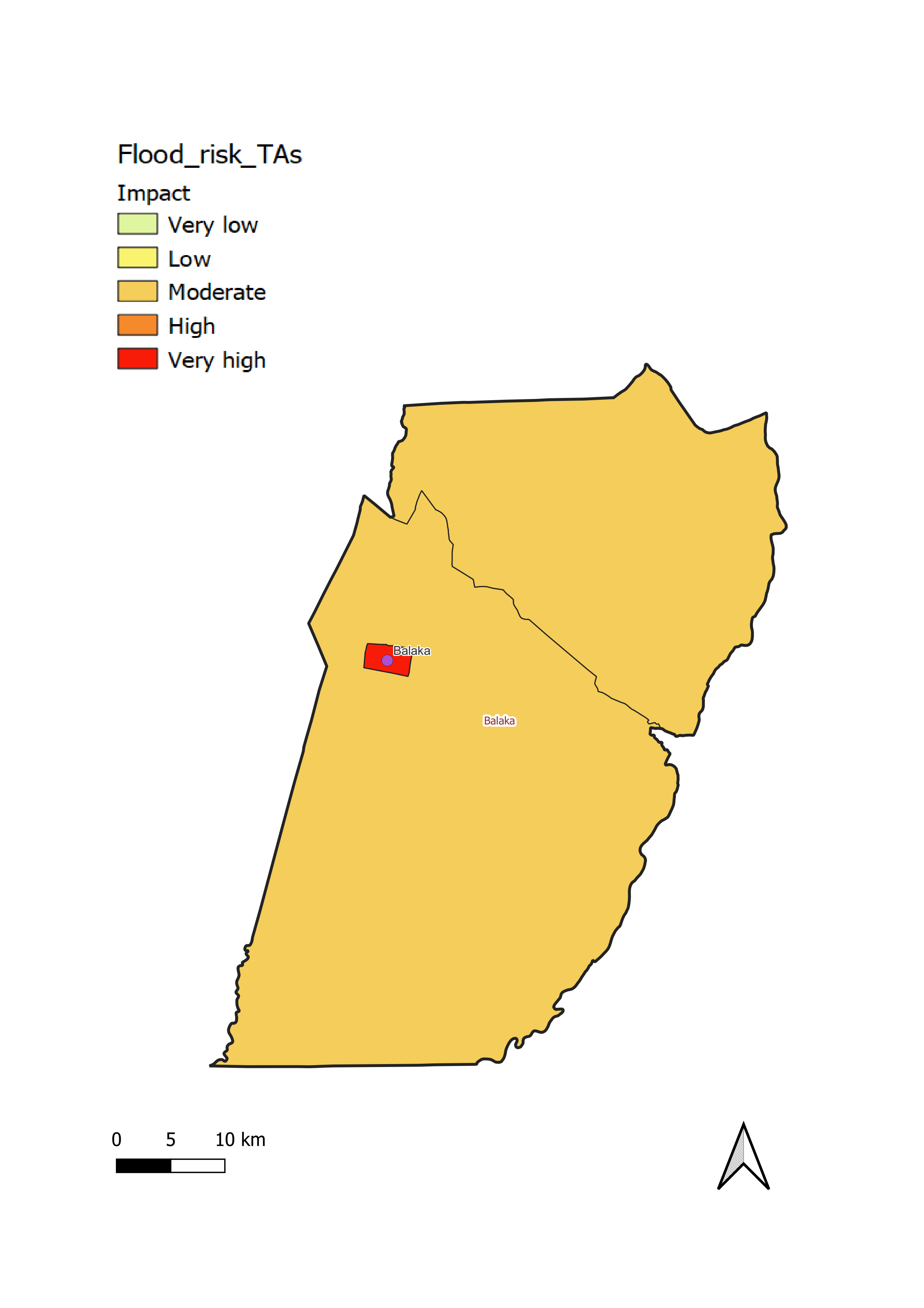
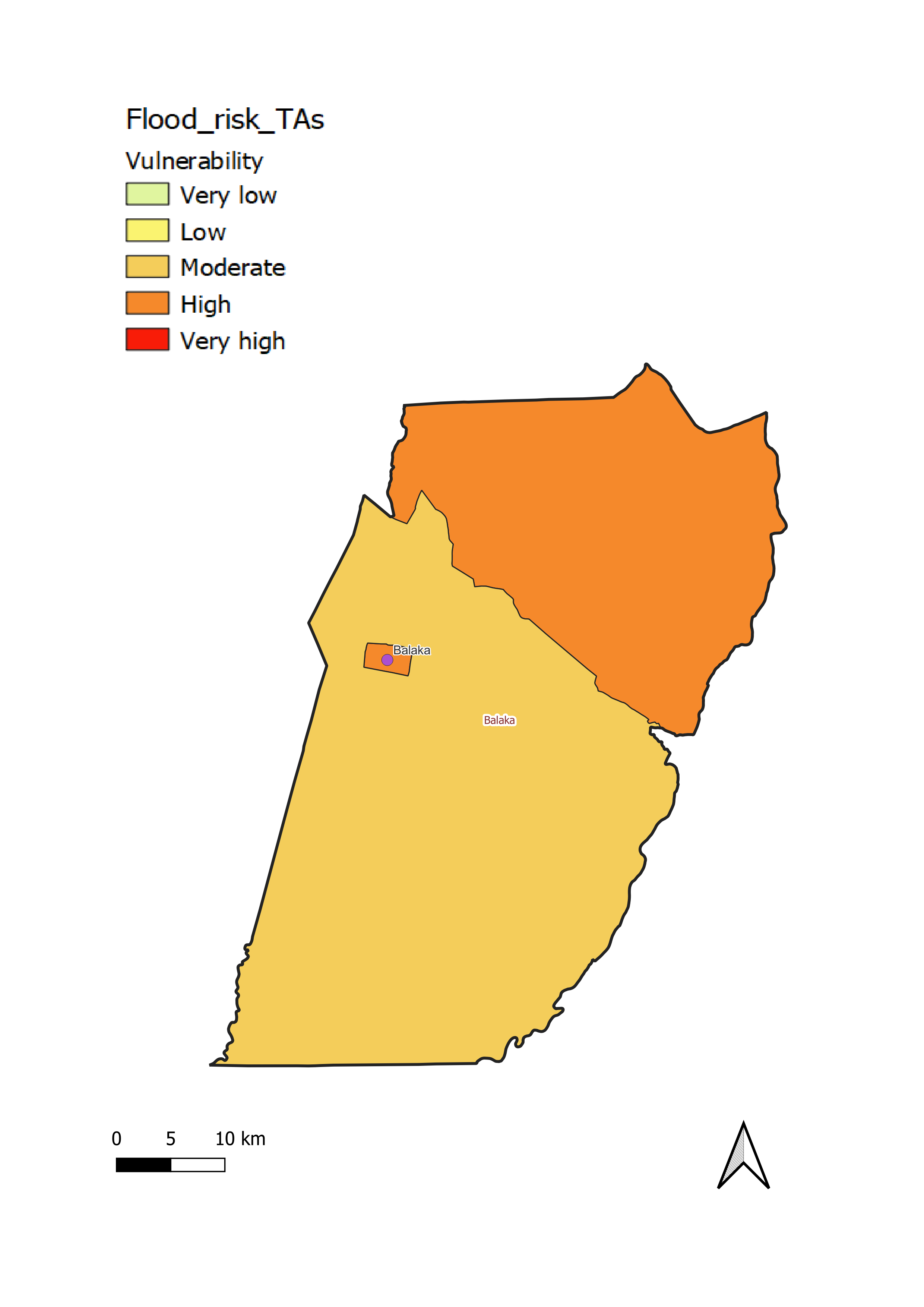
Balaka District exhibits moderate to high flood risk and vulnerability, with most of the district at a moderate level and the northern part at high. There is a moderate level of flood impact throughout the district.
Chikwawa District
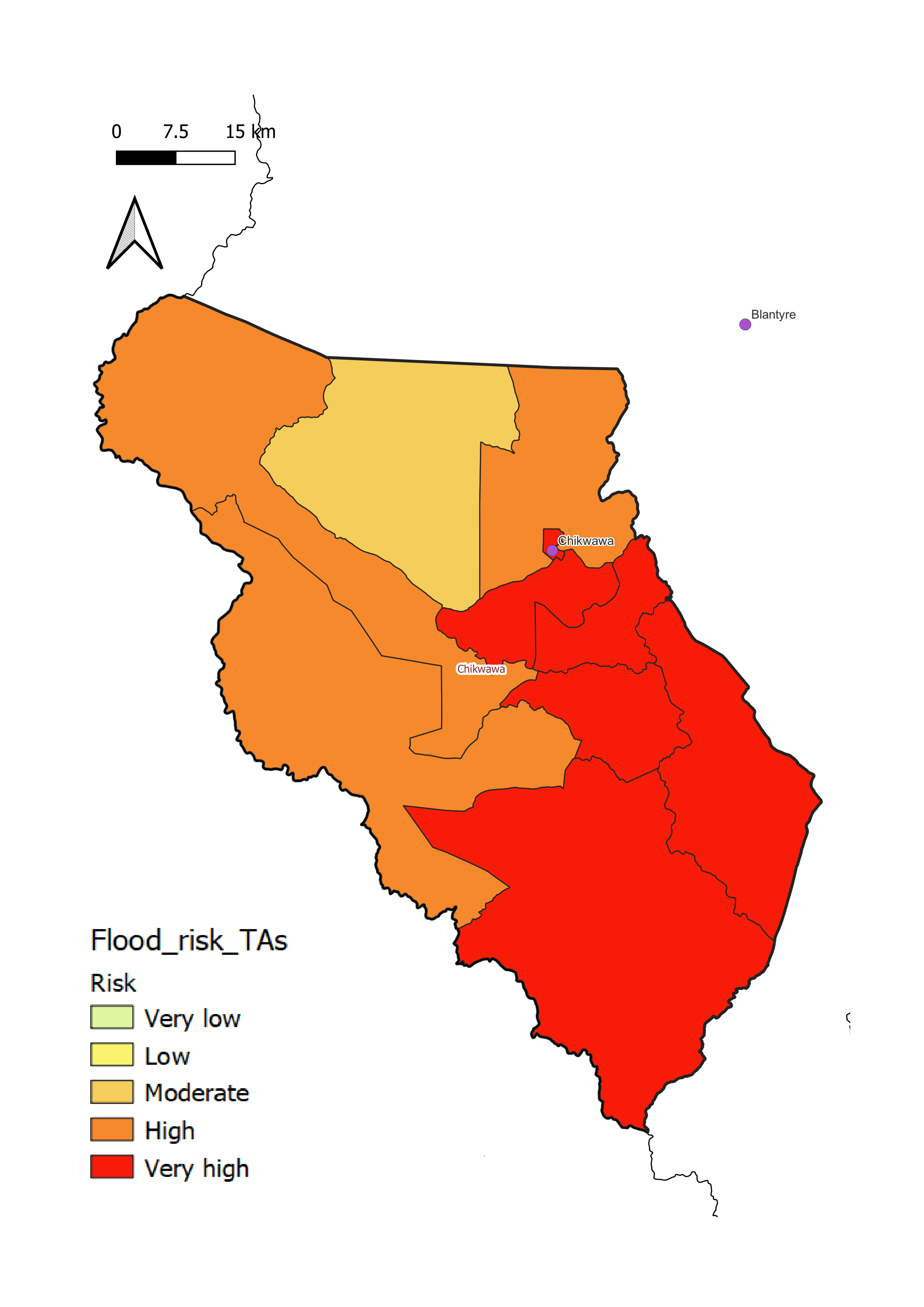
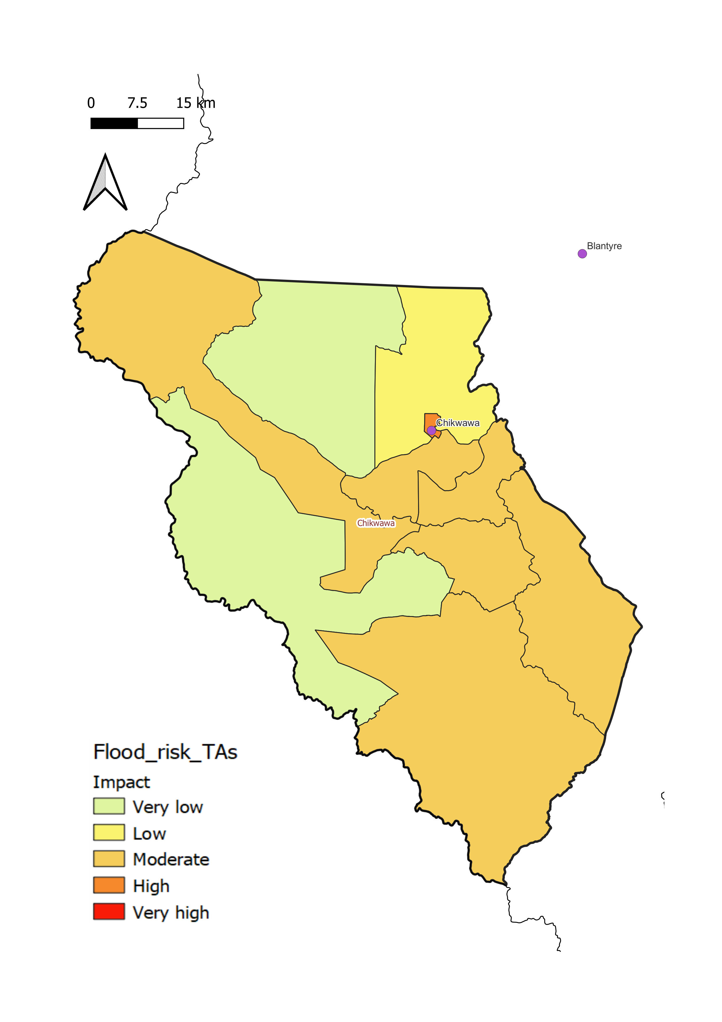
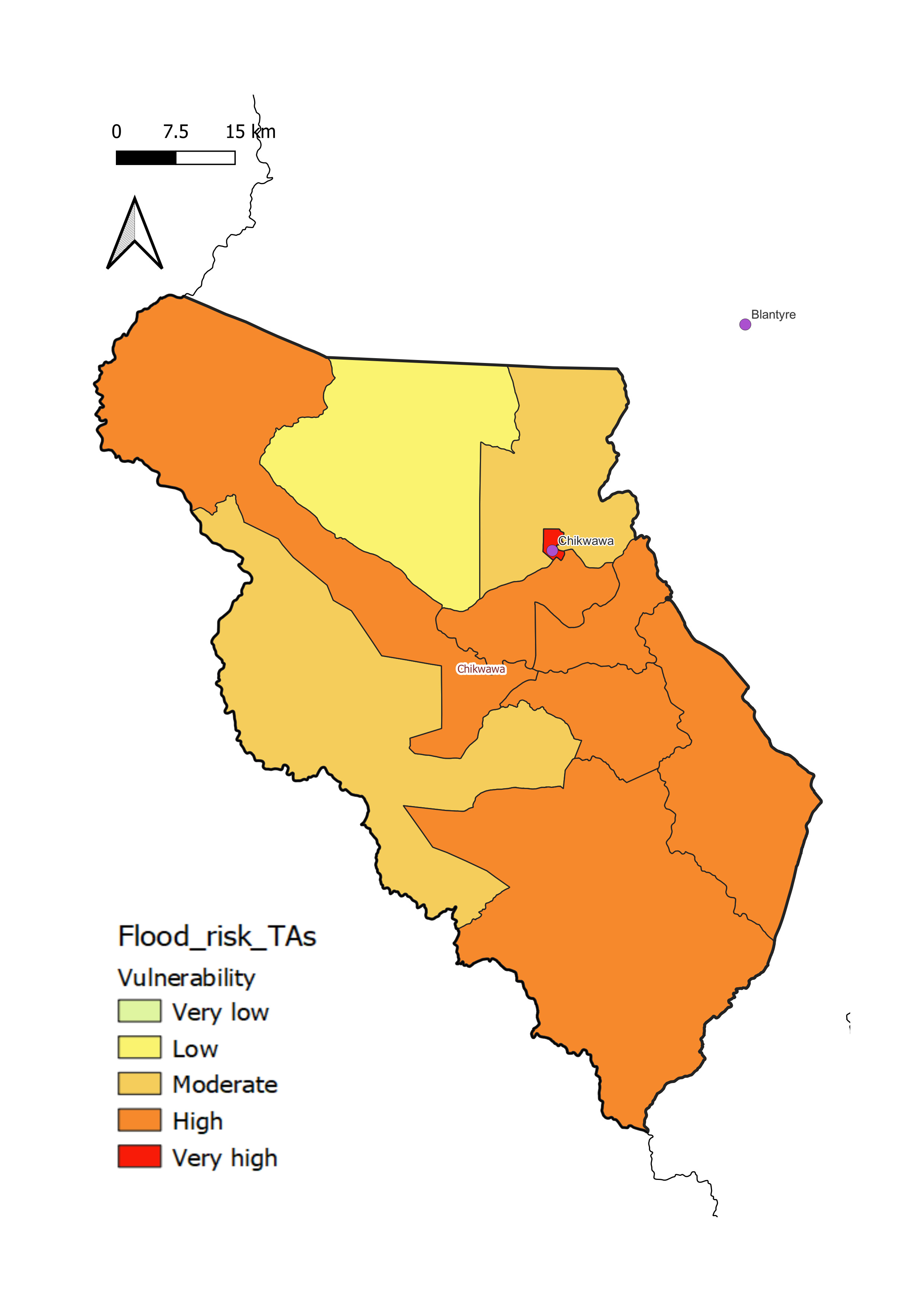
Chikwawa District has a low to high level of flood vulnerability, with much of the district, particularly the low-lying and flat Lower Shire River Valley which flows from the north-west to the south-east across the central and southern part of the district, classified as highly vulnerable.
- aModerate to very high flood risk throughout the district, with most of the area, particularly the southern part, at the very high level of risk.
- bLow to moderate flood impact throughout the district, with most of the area at moderate level of impact.
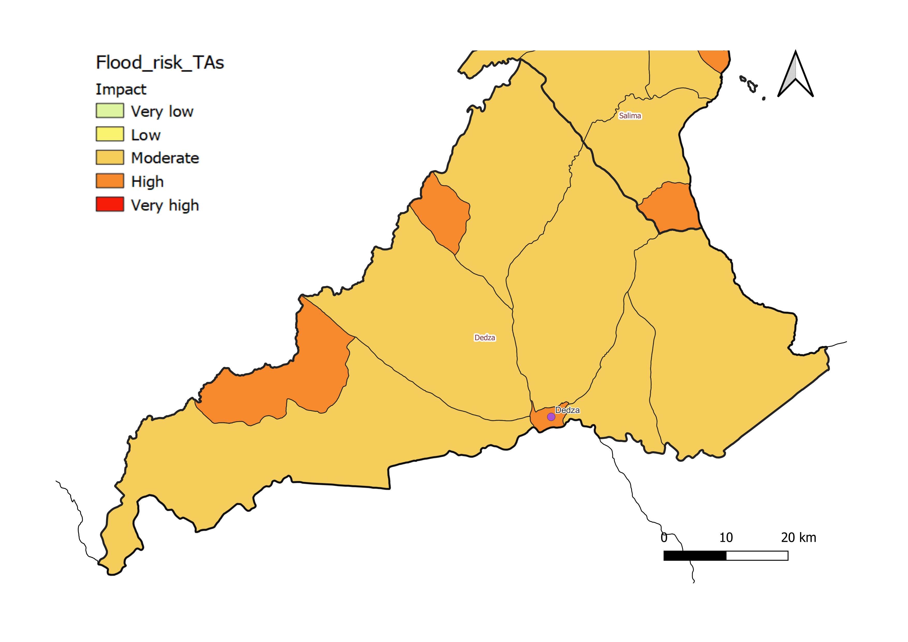
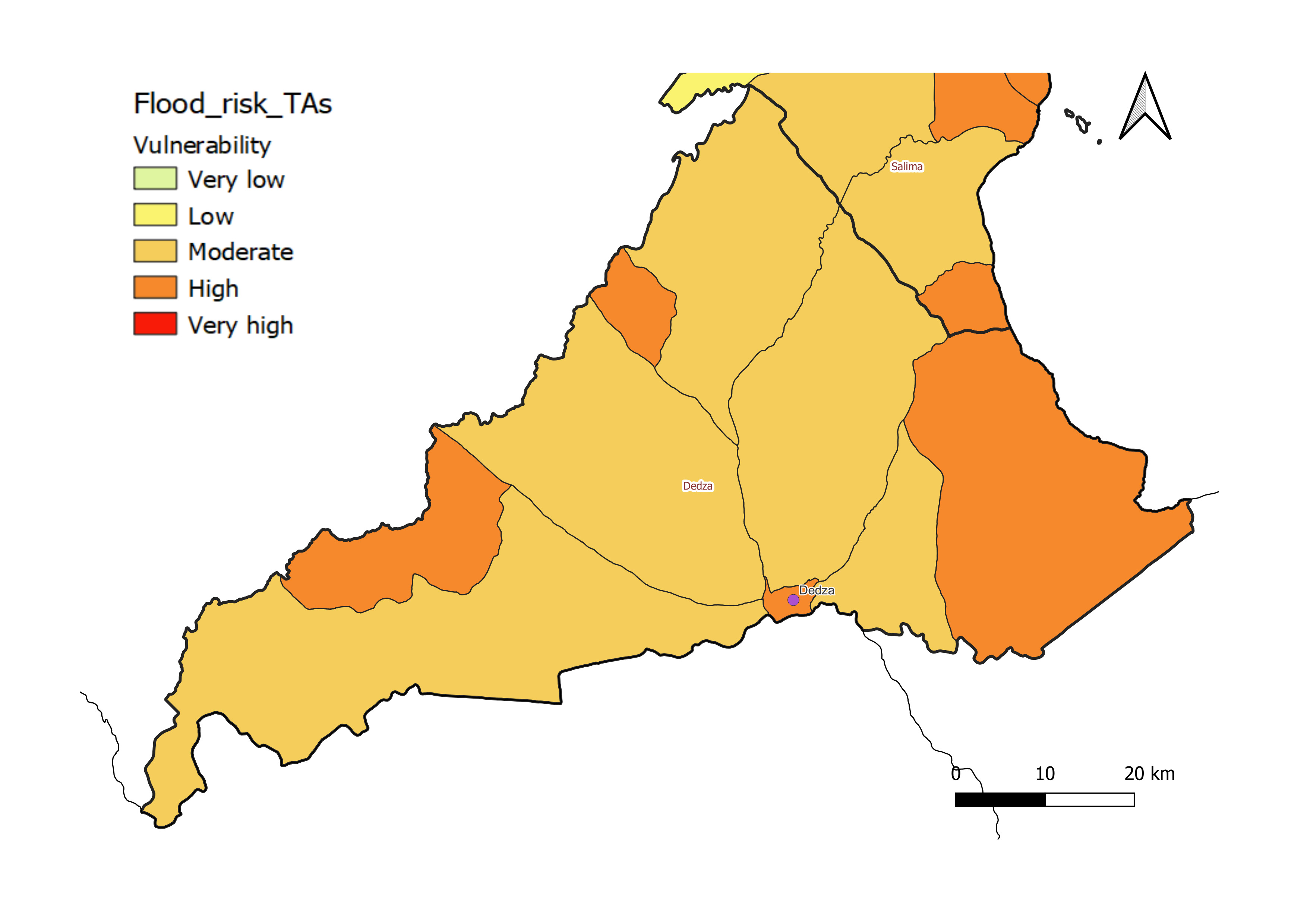
Dedza District
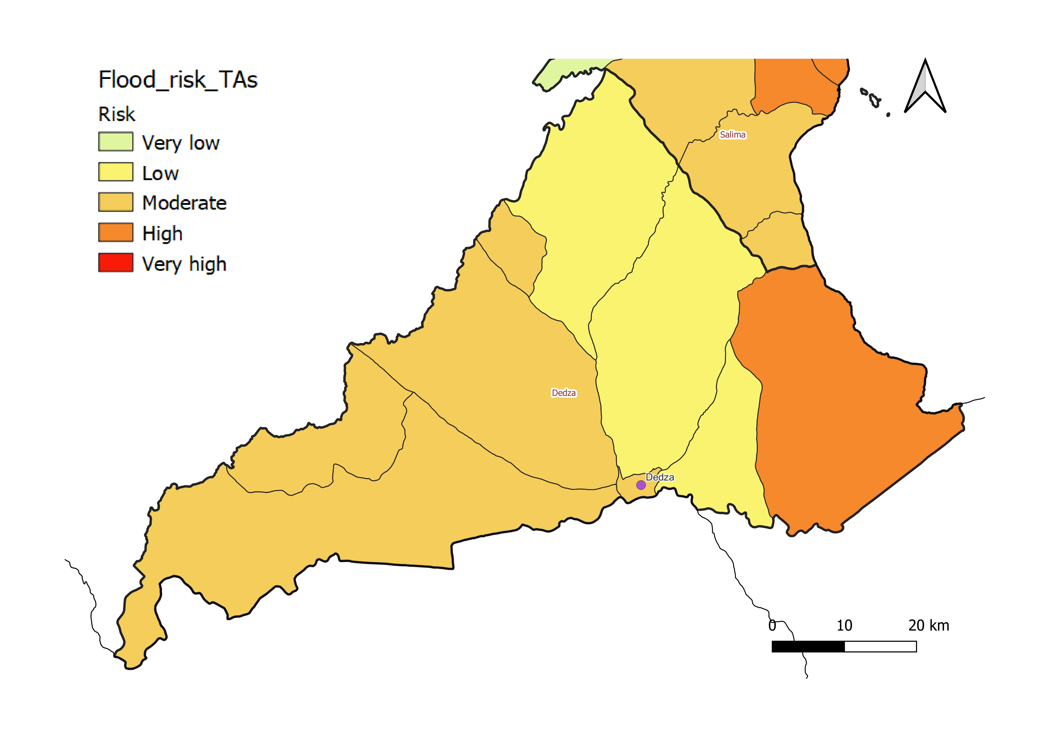
Dedza District has a moderate to high level of flood vulnerability, with some border areas classified as highly vulnerable to flooding.
- aModerate to high flood risk throughout the district, with most of the area at moderate level of risk.
- bLow to high flood impact throughout the district, with most of the area at moderate level of impact.
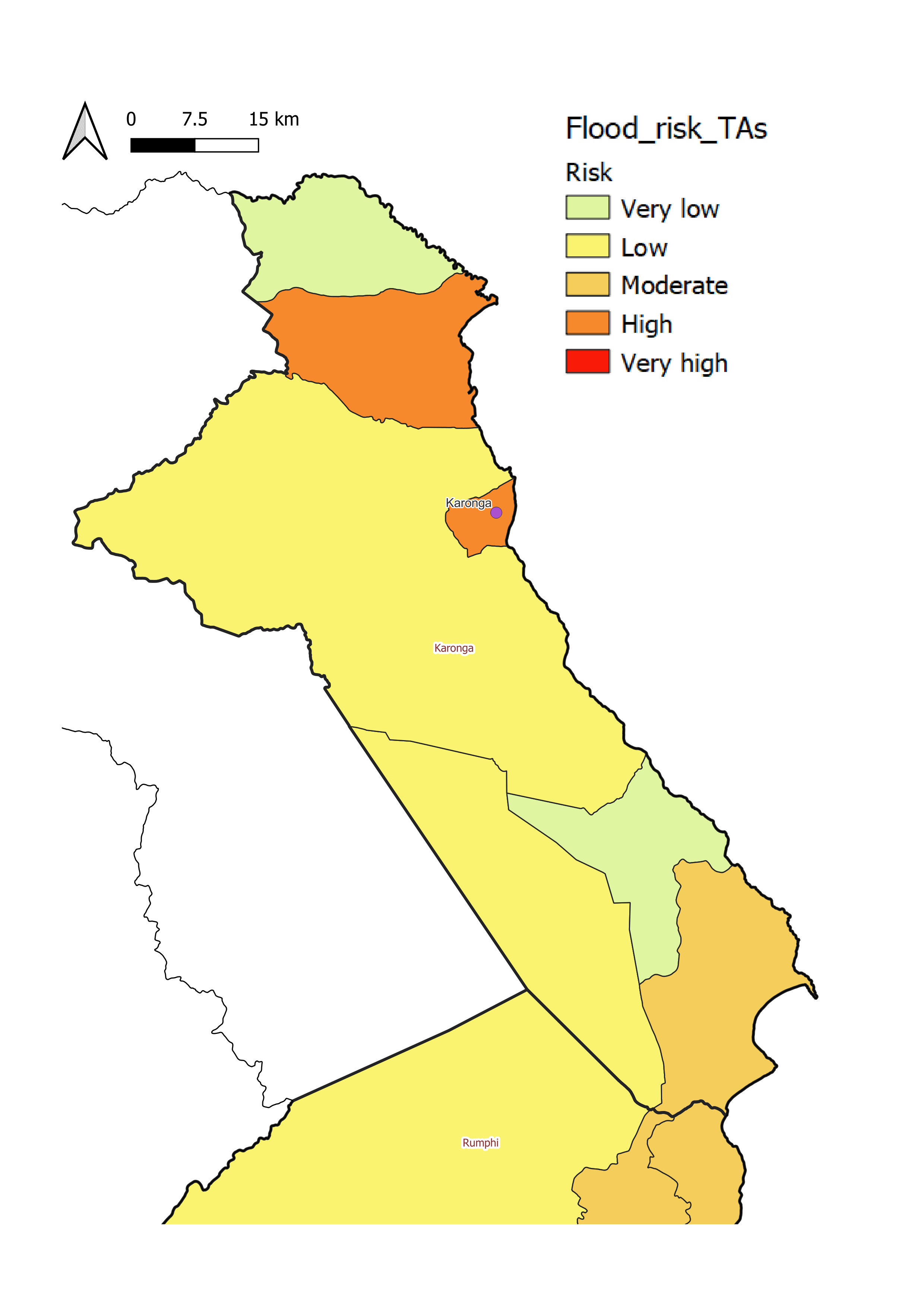
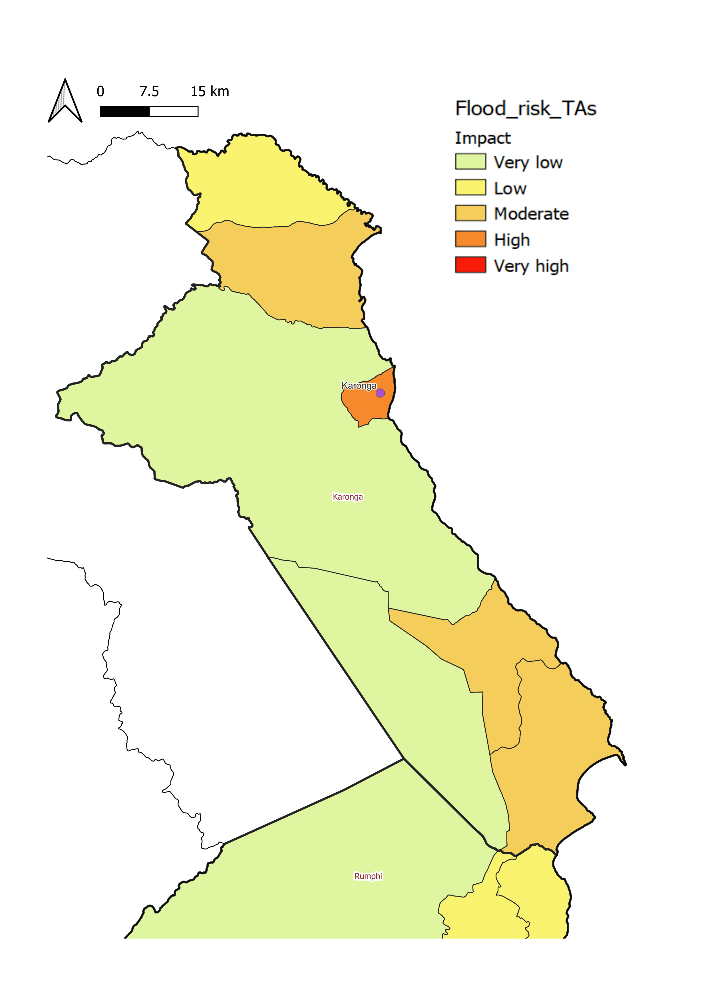
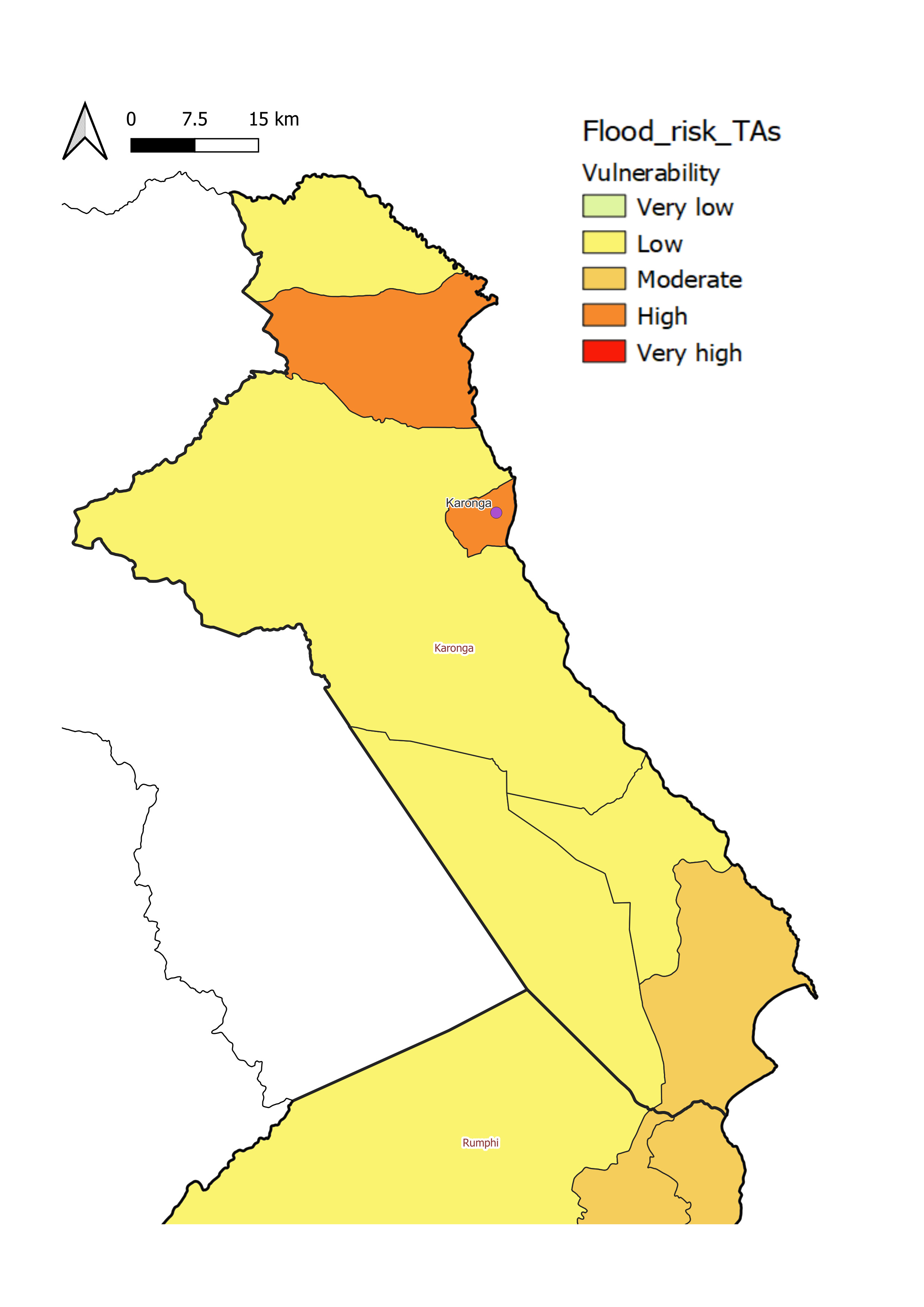
Karonga District
Karonga District has a low to high level of flood vulnerability, with most of the area classified as lowly vulnerable to flooding.
Flooding in Karonga can be pluvial (flash flooding from heavy downpours, especially in low-lying towns with poor drainage such as Karonga), fluvial (rivers overbanking, especially the North Rukuru) or lacustrine (overflow from Lake Malawi, which borders the long eastern boundary of the district) in nature.
- aLow to moderate flood risk throughout the district, with most of the area at low level of risk.
- bLow to high flood impact throughout the district, with most of the area at low level of impact.
Kasungu District
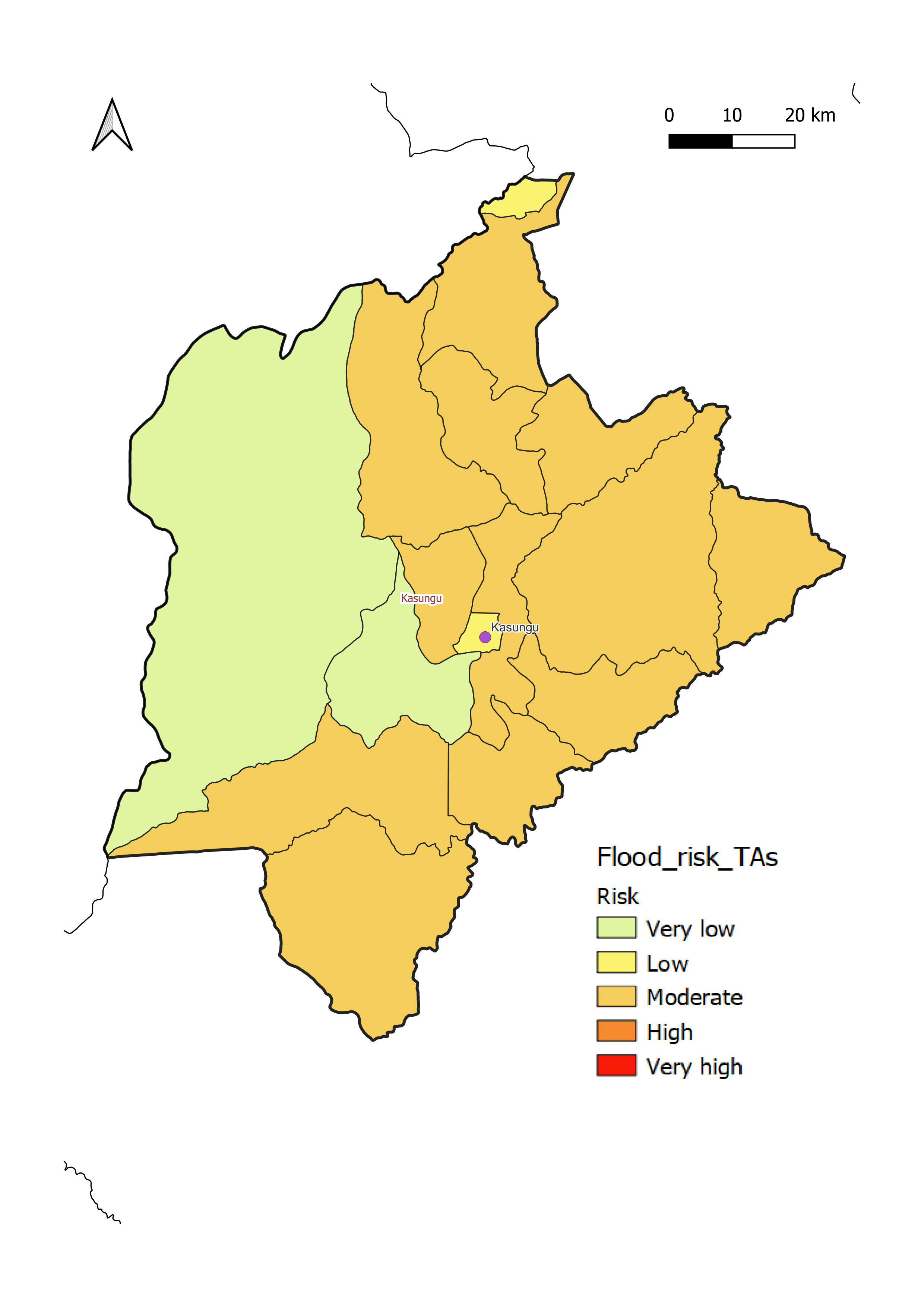
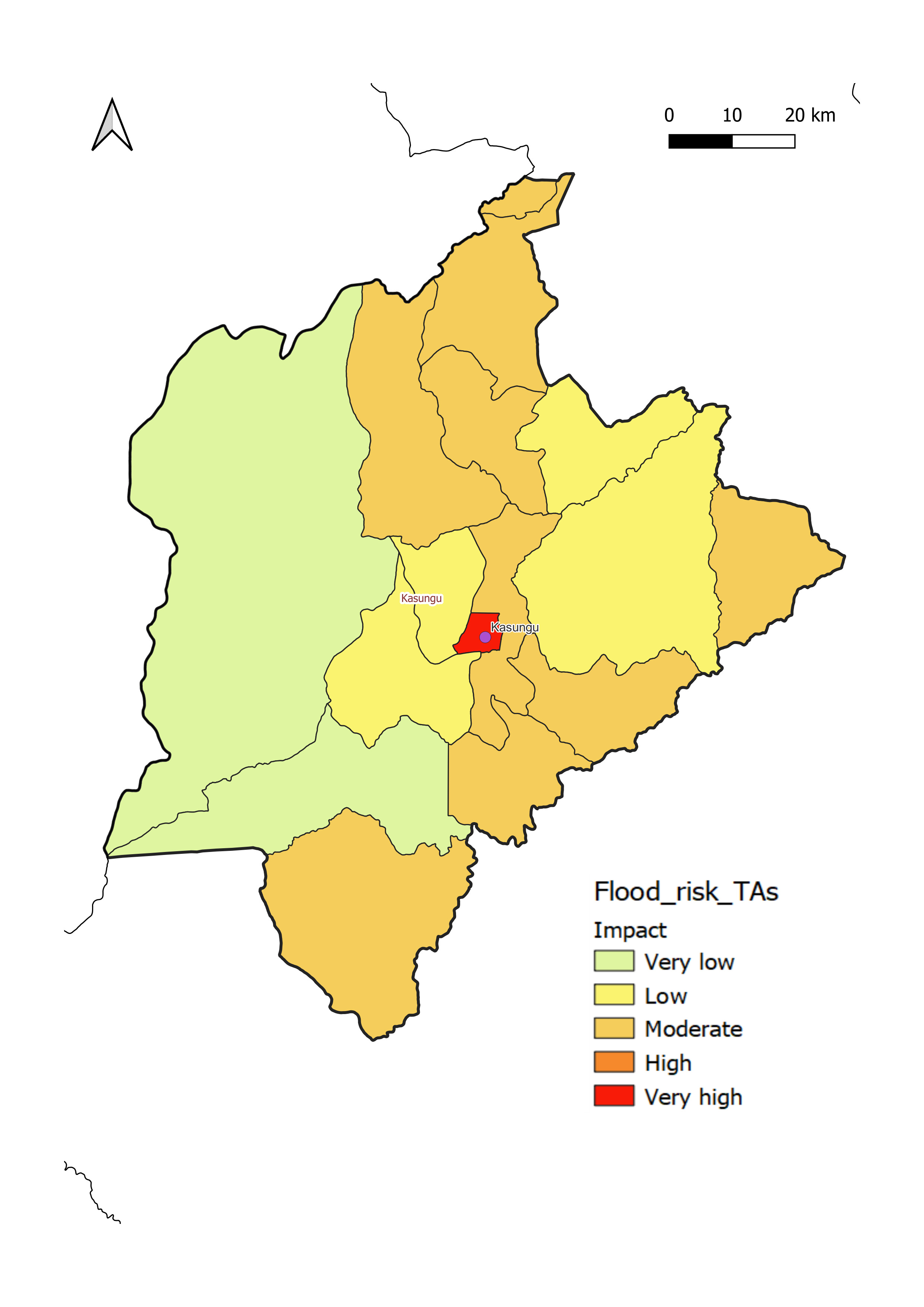
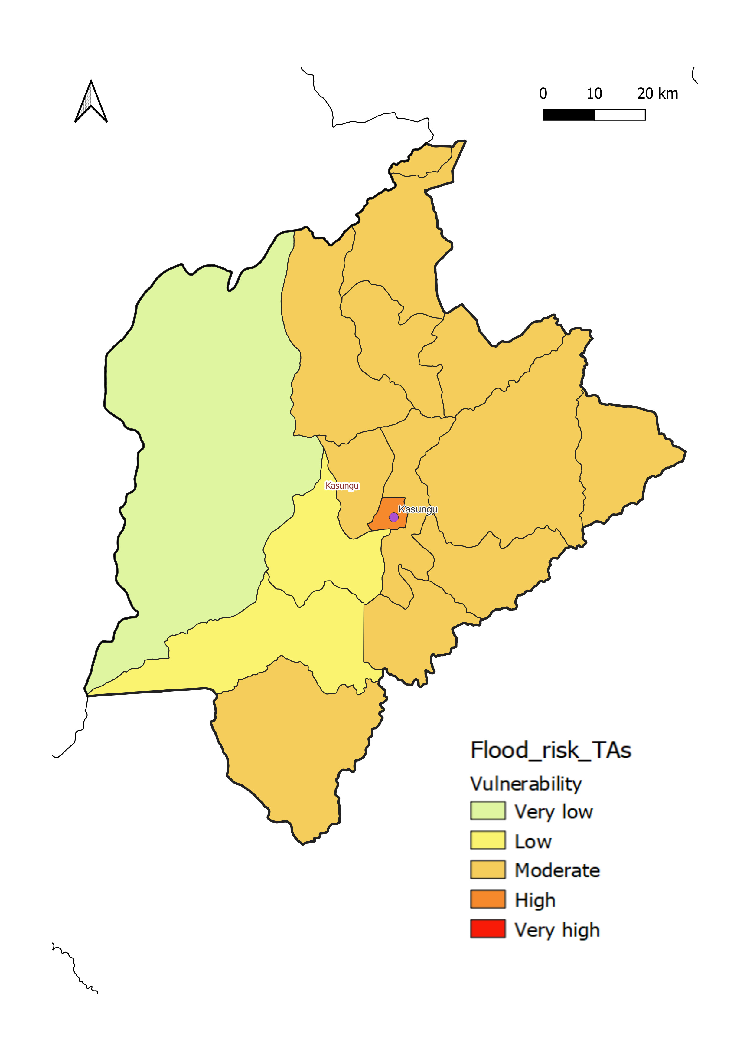
Kasungu District has a low to moderate level of flood vulnerability, with most of the area classified as moderately vulnerable to flooding.
- aLow to moderate flood risk, with most of the area at moderate level of risk.
- bLow to moderate flood impact throughout the district.
Phalombe District
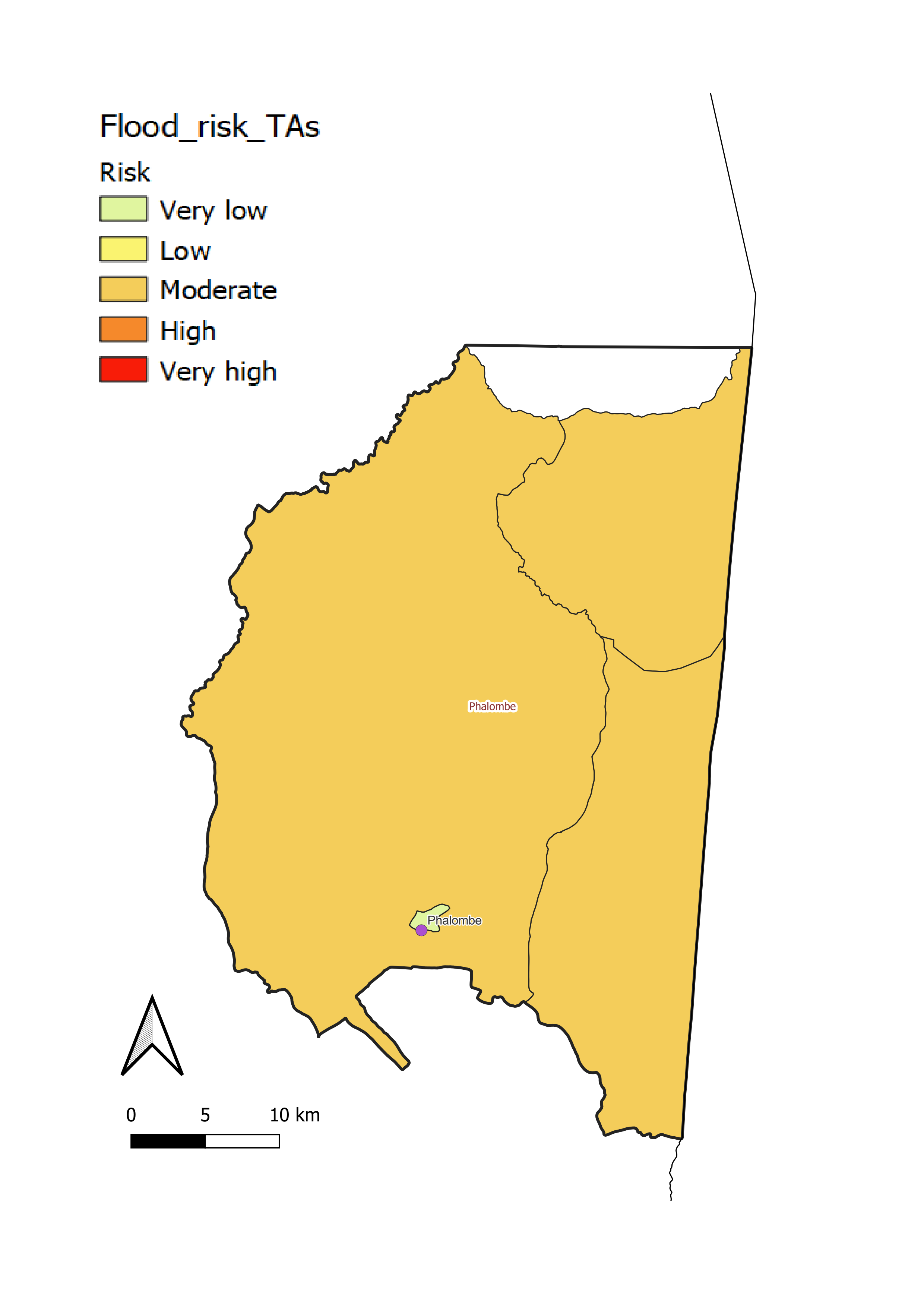
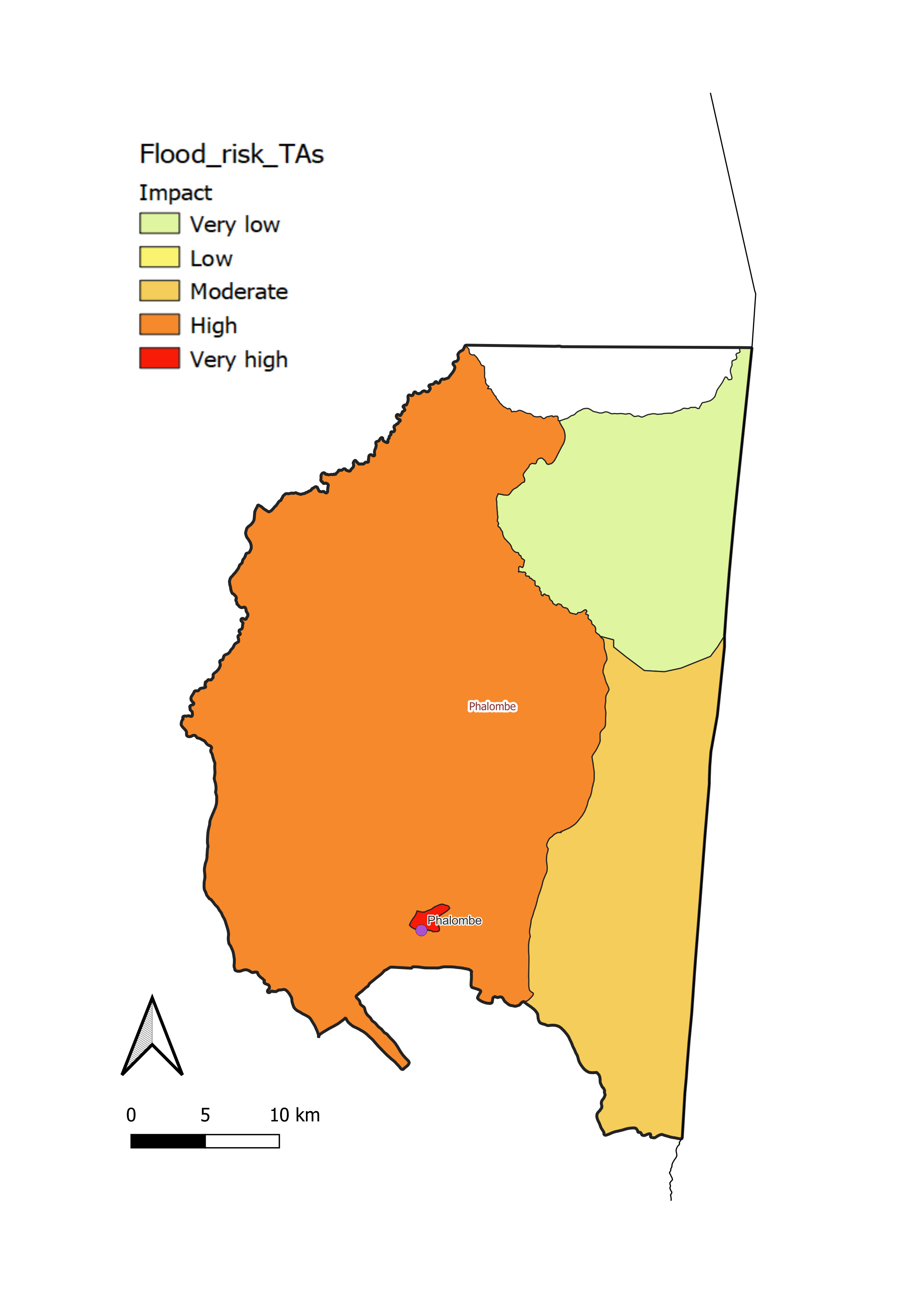
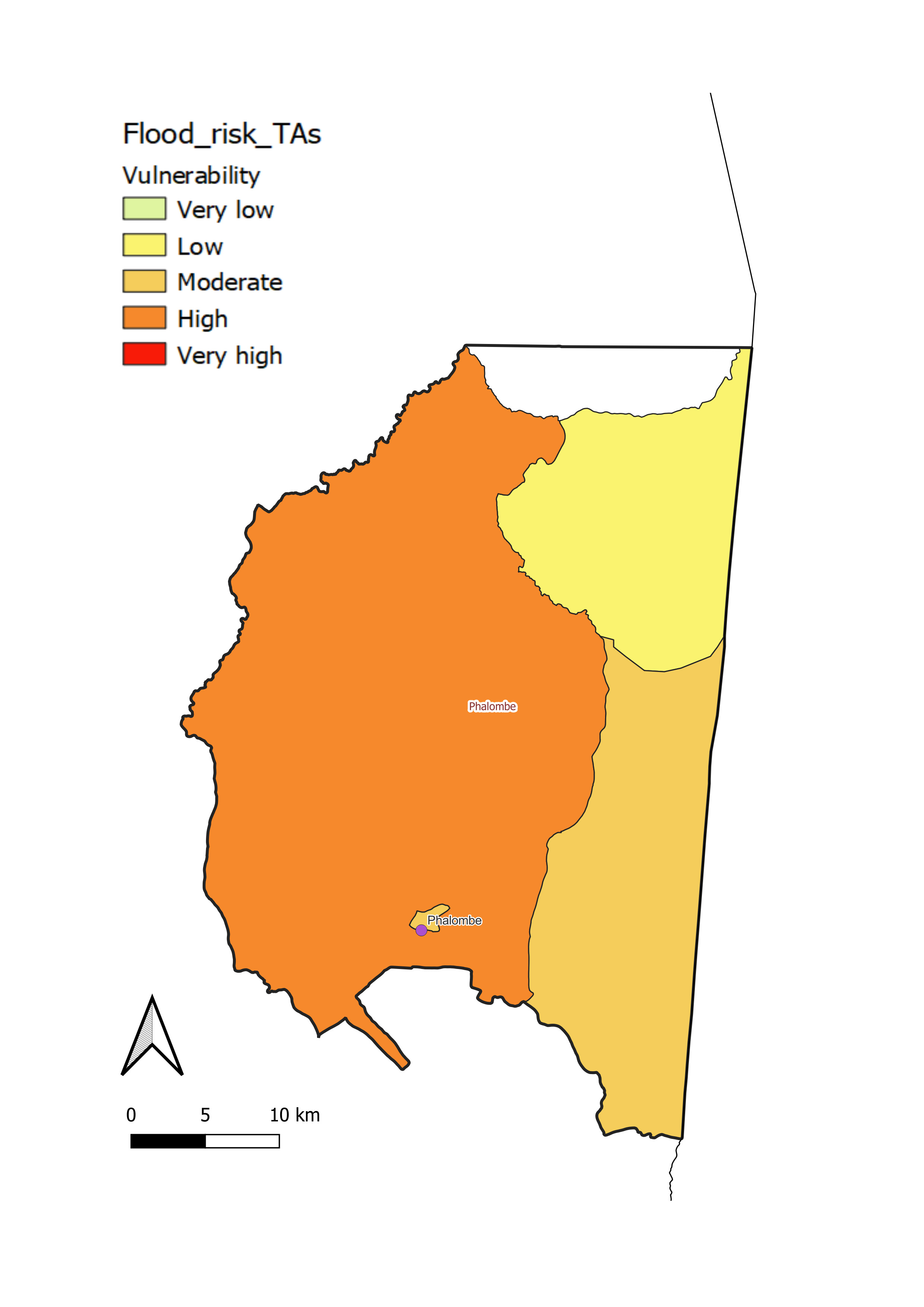
Phalombe District displays a moderate to high level of flood vulnerability, with most of the district classified as highly vulnerable to flooding. An area of particular vulnerability is around the southern shore of endorheic (no outflow) Lake Chilwa in the north of the district and along the River Phalombe, which flows south to north from the Mulanje Massif and feeds into the lake.
- aModerate flood risk throughout the district.
- bLow to high flood impact throughout the district, with most of the district at a high level of impact.
Rumphi District
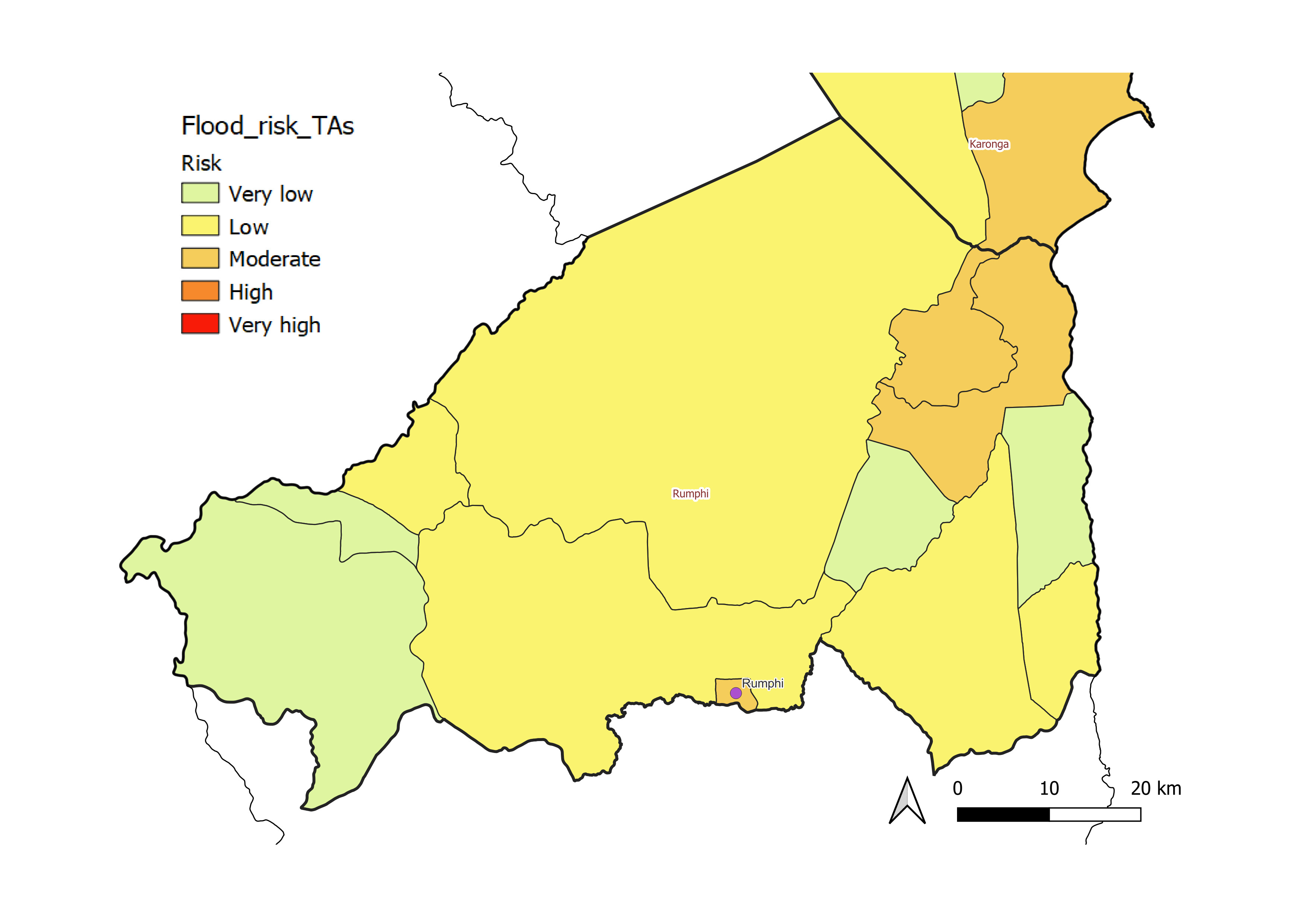
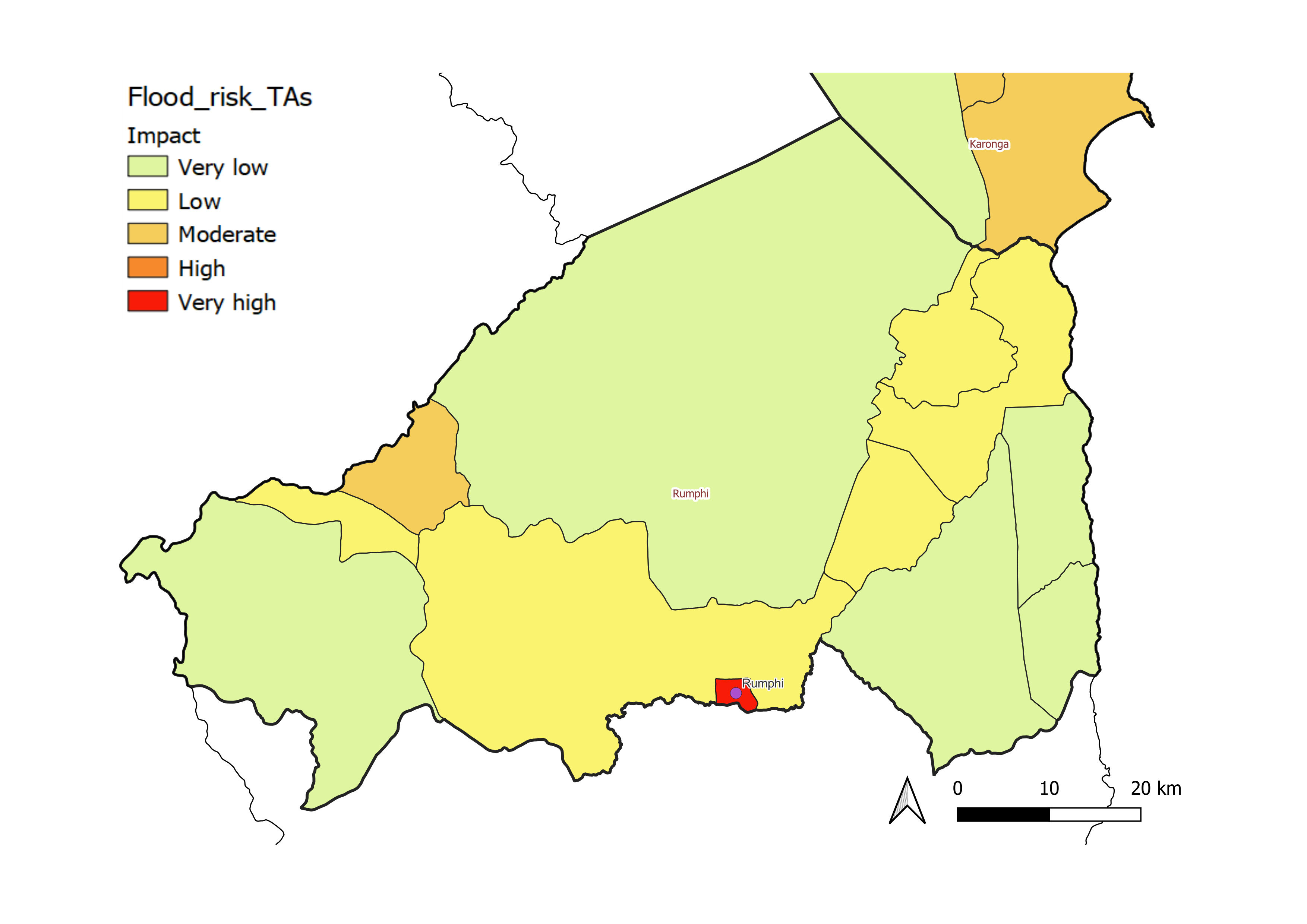
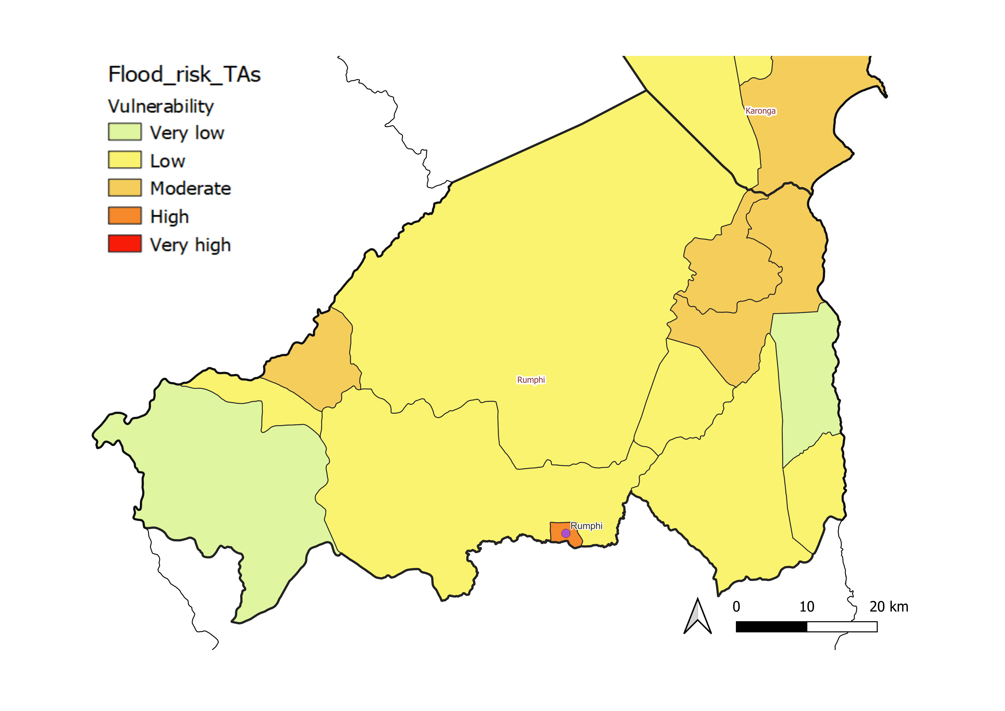
Rumphi District has a very low to moderate level of flood vulnerability, with most of the area classified as lowly vulnerable. This is largely due to the mountainous topography, with very high run-off into streams such as the South Rukuru and Lake Malawi. Due to the abundance of steep slopes, landslides are a particular hazard in this district.
- aVery low to moderate flood risk throughout the district, with most of the area at low level of risk.
- bVery low to moderate flood impact throughout the district, with most of the area at very low level of impact.
Salima District
Salima District has a low to high level of flood vulnerability, with most of the area classified as moderately vulnerable.
The areas most vulnerable and with greatest impact are along the banks of the River Linthipe, which drains the Linthipe Basin from west to east and flows into Lake Malawi at Salima town. Flooding is heightened by large sedimentary deposits close to the outflow, which cause fast-flowing water from inland to back up and overflow.
- aVery low to very high flood risk throughout the district, with most of the area at moderate level of risk.
- bVery low to high flood impact throughout the district, with most of the area at moderate level of impact.